File:ZabuyeLake2.jpg
本预览的尺寸:800 × 444像素。 其他分辨率:320 × 178像素 | 640 × 355像素 | 929 × 516像素。
原始文件 (929 × 516像素,文件大小:114 KB,MIME类型:image/jpeg)
摘要
| 描述 |
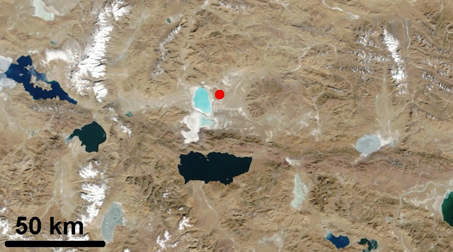
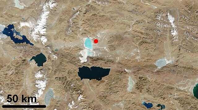
English: Map of Tibet showing the Ngangle Ringco Lake on the left and the Zabuye Lake marked with the red dot |
| 日期 | |
| 来源 | http://visibleearth.nasa.gov/view_rec.php?id=4806 |
| 作者 | NASA |
许可协议
| 本文件完全由NASA创作,在美国属于公有领域。根据NASA的版权方针,NASA的材料除非另有声明否则不受版权保护。(参见Template:PD-USGov/zh、NASA版权方针页面或JPL图片使用方针。) | ||
 |
警告:
|
文件历史
点击某个日期/时间查看对应时刻的文件。
| 日期/时间 | 缩略图 | 大小 | 用户 | 备注 | |
|---|---|---|---|---|---|
| 当前 | 2010年9月11日 (六) 03:03 | | 929 × 516(114 KB) | Materialscientist | {{Information |Description={{en|1=Map of Tibet showing the Ngangle Ringco Lake on the left and the Zabuye Lake marked with the red dot}} |Source=http://visibleearth.nasa.gov/view_rec.php?id=4806 |Author=NASA |Date=June 08 2006 |Permission= |other_versions |
文件用途
以下页面使用本文件:
全域文件用途
以下其他wiki使用此文件:
- ceb.wikipedia.org上的用途
- de.wikipedia.org上的用途
- en.wikipedia.org上的用途
- pa.wikipedia.org上的用途
- ru.wikipedia.org上的用途
- sv.wikipedia.org上的用途
- uk.wikipedia.org上的用途