File:Floods in the Philippines 4 Dec 2004.jpg
原始檔案 (2,400 × 3,200 像素,檔案大小:1.29 MB,MIME 類型:image/jpeg)
摘要
| 描述 |
English: Text from the image entry on NASA Visible Earth –
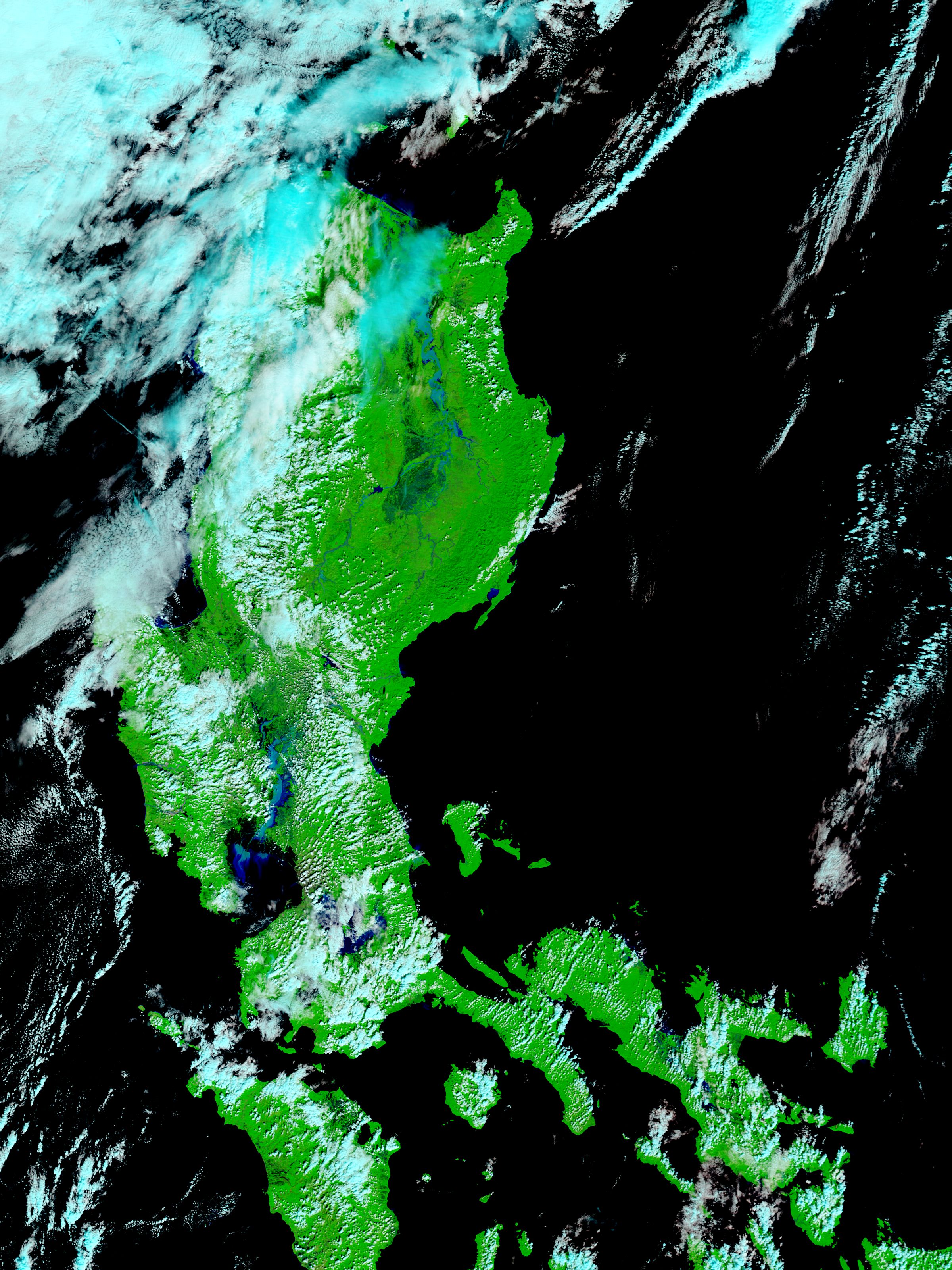
Four tropical storms in two weeks have saturated Luzon Island, the main island in the Philippines, causing devastating flooding. The Moderate Resolution Imaging Spectroradiometer (MODIS) on NASA’s Terra satellite captured this image of the island after the clouds from the most recent storm, Typhoon Nanmadol, cleared on December 4, 2004. Rivers throughout the island are swollen far beyond their normal size, as shown in the comparison image acquired on October 19. The most dramatic flooding is along the Cagayan River in the north and the Pampanga River in the south, but other rivers are also swollen. Further evidence of flooding is in the color of the water. In this false color treatment, water is typically dark blue or black. In the flood image, the water is light blue—a sign that it is tinted with sediment. A light blue plume in Manila Bay is also sediment. As flood waters gush over the land, they carry mud into the rivers and the surrounding ocean. The sediment is more obvious in the true color version of the image, where Manila Bay appears to be filled with mud. Over 1,000 people are dead or missing as a result of flooding and landslides in the past week, according to media reports. The most severely impacted communities are in the Sierra Madre, where landslides buried whole communities. |
| 日期 | |
| 來源 | http://visibleearth.nasa.gov/view.php?id=72350 |
| 作者 | NASA, MODIS Rapid Response |
授權條款
| 本作品由NASA創作,屬於公有領域。根據NASA的版權政策:“NASA的創作除非另有聲明否則不受版權保護。”(參見:Template:PD-USGov/zh,NASA版權政策或JPL圖像使用政策) | ||
 |
警告:
|
檔案歷史
點選日期/時間以檢視該時間的檔案版本。
| 日期/時間 | 縮圖 | 尺寸 | 使用者 | 備註 | |
|---|---|---|---|---|---|
| 目前 | 2014年6月2日 (一) 22:54 | | 2,400 × 3,200(1.29 MB) | TheAustinMan | User created page with UploadWizard |
檔案用途
下列頁面有用到此檔案:
全域檔案使用狀況
以下其他 wiki 使用了這個檔案:
- en.wikipedia.org 的使用狀況