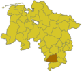
File:Lower saxony nom.png
Lower_saxony_nom.png (280 × 245 像素,檔案大小:15 KB,MIME 類型:image/png)
檔案歷史
點選日期/時間以檢視該時間的檔案版本。
| 日期/時間 | 縮圖 | 尺寸 | 使用者 | 備註 | |
|---|---|---|---|---|---|
| 目前 | 2011年4月7日 (四) 23:06 |  | 280 × 245(15 KB) | Purple acid | Added the border between the exclave Fürstenhagen, which is a district of the city of Uslar, and the Landkreis Göttingen. Furthermore, added the area of Fürstenhagen to the area of the Landkreis Northeim. Die Grenze der Exklave Fürstenhagen (Ortsteil |
| 2006年2月28日 (二) 12:23 |  | 280 × 245(13 KB) | Tsca.bot | Karte Niedersachsens mit dem Landkreis Nordheim Karten sind selbsterstellt, z.T. durch triviales Ausmalen der Vorlagen aus [http://en.wikipedia.org/wiki/Wikipedia:WikiProject_German_districts/Maptemplates]. Daher allesamt GFDL. {{GFDL}} [[Category:Maps |
檔案用途
下列頁面有用到此檔案:
全域檔案使用狀況
以下其他 wiki 使用了這個檔案:
- id.wikipedia.org 的使用狀況
- ka.wikipedia.org 的使用狀況
- kk.wikipedia.org 的使用狀況
- ro.wikipedia.org 的使用狀況
- ru.wikipedia.org 的使用狀況
- stq.wikipedia.org 的使用狀況
- sv.wikipedia.org 的使用狀況
- vi.wikipedia.org 的使用狀況
- www.wikidata.org 的使用狀況


