File:NGA New HQ.jpg
預覽大小:750 × 600 像素。 其他解析度:300 × 240 像素 | 600 × 480 像素 | 960 × 768 像素 | 1,280 × 1,024 像素 | 2,560 × 2,048 像素 | 3,000 × 2,400 像素。
原始檔案 (3,000 × 2,400 像素,檔案大小:4.27 MB,MIME 類型:image/jpeg)
摘要
| 描述 |
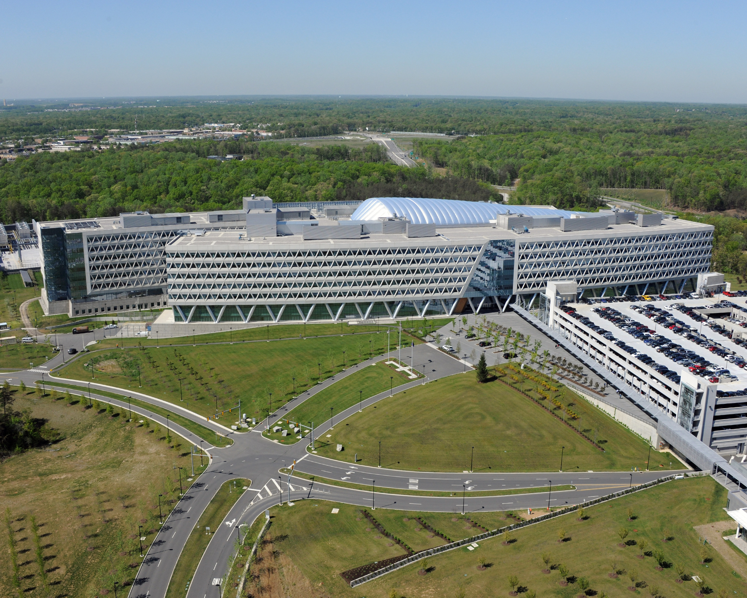
English: National Geospatial-Intelligence Agency East facility - exterior view |
| 日期 | |
| 來源 | https://www.flickr.com/photos/nga_geoint/9364834965/ |
| 作者 | "Photo: National Geospatial-Intelligence Agency" |
授權條款
This image is a work of the United States National Geospatial-Intelligence Agency or one of its predecessor agencies. As a work of the U.S. federal government, the image is in the public domain.
|
 |
檔案歷史
點選日期/時間以檢視該時間的檔案版本。
| 日期/時間 | 縮圖 | 尺寸 | 使用者 | 備註 | |
|---|---|---|---|---|---|
| 目前 | 2021年10月17日 (日) 04:50 | | 3,000 × 2,400(4.27 MB) | Abovfold | higher resolution source |
| 2011年12月2日 (五) 23:48 |  | 500 × 333(96 KB) | Saibo | full size from http://www.federalnewsradio.com/?nid=97&sid=2564726 image 3/11 → [http://www.federalnewsradio.com/emedia/wtop/22/2268/226882.jpg] | |
| 2011年12月1日 (四) 00:59 |  | 350 × 233(60 KB) | Ceradon |
檔案用途
下列頁面有用到此檔案:
全域檔案使用狀況
以下其他 wiki 使用了這個檔案:
- ar.wikipedia.org 的使用狀況
- ca.wikipedia.org 的使用狀況
- de.wikipedia.org 的使用狀況
- en.wikipedia.org 的使用狀況
- es.wikipedia.org 的使用狀況
- fa.wikipedia.org 的使用狀況
- he.wikipedia.org 的使用狀況
- id.wikipedia.org 的使用狀況
- it.wikipedia.org 的使用狀況
- no.wikipedia.org 的使用狀況
- ru.wikipedia.org 的使用狀況
- simple.wikipedia.org 的使用狀況
- sv.wikipedia.org 的使用狀況
- tr.wikipedia.org 的使用狀況
- www.wikidata.org 的使用狀況