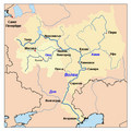
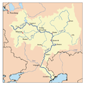
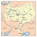
無更高解析度可提供。
我,本作品的著作權持有者,決定用以下授權條款發佈本作品:
您可以自由:
分享 – 複製、發佈和傳播本作品重新修改 – 創作演繹作品
惟需遵照下列條件:
姓名標示 – 您必須指名出正確的製作者,和提供授權條款的連結,以及表示是否有對內容上做出變更。您可以用任何合理的方式來行動,但不得以任何方式表明授權條款是對您許可或是由您所使用。相同方式分享 – 如果您利用本素材進行再混合、轉換或創作,您必須基於如同原先的相同或兼容的條款 ,來分布您的貢獻成品。 https://creativecommons.org/licenses/by-sa/2.5 CC BY-SA 2.5 Creative Commons Attribution-Share Alike 2.5 true true
This image is a derivative work of the following images:
File:Volgarivermap.png licensed with Cc-by-sa-2.5
2007-07-23T17:06:38Z Kmusser 500x500 (158262 Bytes) Ural river fix
2006-10-17T14:50:44Z Kmusser 500x500 (40459 Bytes)
2006-08-31T20:15:10Z Kmusser 500x500 (128632 Bytes) This is a map of the [[:en:Volga River|Volga River]] system. I, [[:en:User:Kmusser|Karl Musser]], created it based on [[:en:USGS|USGS]] data. {{self|cc-by-sa-2.5}} [[Category:Maps of rivers]] Uploaded with derivativeFX
檔案歷史
點選日期/時間以檢視該時間的檔案版本。
日期/時間 縮圖 尺寸 使用者 備註 目前 2010年9月29日 (三) 19:10 500 × 500(159 KB) Nessa los {{Information |Description={{es|Mapa de los alrededores del Río Volga.}} |Source=*File:Volgarivermap.png |Date=2010-09-29 19:07 (UTC) |Author=*File:Volgarivermap.png : Kmusser *derivative work: Nessa |Permis
檔案用途
全域檔案使用狀況
以下其他 wiki 使用了這個檔案:
es.wikipedia.org 的使用狀況
pl.wikivoyage.org 的使用狀況


