File:Edificio Fuller (Flatiron) en 2010 desde el Empire State crop boxin.jpg

預覽大小:317 × 600 像素。 其他解析度:127 × 240 像素 | 253 × 480 像素 | 406 × 768 像素 | 541 × 1,024 像素 | 1,489 × 2,818 像素。
原始檔案 (1,489 × 2,818 像素,檔案大小:702 KB,MIME 類型:image/jpeg)
摘要
| 拍攝地點 | | 位於此地的本圖片與其他圖片: OpenStreetMap |
|---|
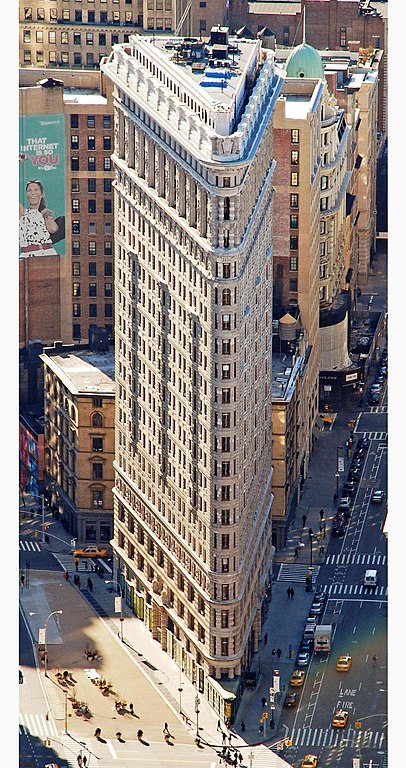
| 描述 | Flatiron Building (formerly the Fuller Building), Manhattan, New York. | ||
| 日期 | |||
| 來源 |
|
||
| 作者 | Imelenchon (original work) | ||
| 授權許可 (重用此檔案) |
|
||
| 其他版本 |
_en_2010_desde_el_Empire_State.jpg)
_en_2010_desde_el_Empire_State_crop_boxin.jpg?uselang=zh-hk)
_en_2010_desde_el_Empire_State_crop_boxin.jpg?uselang=zh-hk)
_en_2010_desde_el_Empire_State_crop_boxin.jpg?action=history&uselang=zh-hk)
_en_2010_desde_el_Empire_State_crop_boxin.jpg)
_en_2010_desde_el_Empire_State_crop_boxin.jpg¶ms=040.742339_N_-073.988908_E_globe:Earth_type:camera_region:US_heading:202.50&language=zh-hk)

|
根據最有價值圖像標準,這張圖像被評定为在Flatiron Building, New York範疇內最有價值的共享資源圖像。你可以在Commons:Valued image candidates/Edificio Fuller (Flatiron) en 2010 desde el Empire State crop boxin.jpg参看它的提名。 |
_en_2010_desde_el_Empire_State_crop_boxin.jpg)
檔案歷史
點選日期/時間以檢視該時間的檔案版本。
| 日期/時間 | 縮圖 | 尺寸 | 用戶 | 備註 | |
|---|---|---|---|---|---|
| 目前 | 2011年1月21日 (五) 03:39 | | 1,489 × 2,818(702 KB) | Beyond My Ken | Adjust side panels |
| 2011年1月21日 (五) 03:32 |  | 1,613 × 2,818(703 KB) | Beyond My Ken | Straighten | |
| 2011年1月21日 (五) 03:17 |  | 1,723 × 2,886(763 KB) | Beyond My Ken | {{Information |Description={{en|1=Fuller building (Flatiron)}} {{es|1=Edificio Fuller (Flatiron)}} {{ca|1=Edifici Fuller (Flatiron)}} |Source=File:Edificio Fuller (Flatiron) en 2010 desde el Empire State.jpg |Author=Imelenchon; cr |
_en_2010_desde_el_Empire_State.jpg)
檔案用途
下列頁面有用到此檔案:
全域檔案使用狀況
以下其他 wiki 使用了這個檔案:
- ar.wikipedia.org 的使用狀況
- ast.wikipedia.org 的使用狀況
- az.wikipedia.org 的使用狀況
- be.wikipedia.org 的使用狀況
- bg.wikipedia.org 的使用狀況
- bn.wikipedia.org 的使用狀況
- cs.wikipedia.org 的使用狀況
- de.wikipedia.org 的使用狀況
- de.wikivoyage.org 的使用狀況
- el.wikipedia.org 的使用狀況
- en.wikipedia.org 的使用狀況
- en.wikivoyage.org 的使用狀況
- es.wikipedia.org 的使用狀況
- eu.wikipedia.org 的使用狀況
- fa.wikipedia.org 的使用狀況
- fi.wikipedia.org 的使用狀況
- fr.wikipedia.org 的使用狀況
- fr.wikivoyage.org 的使用狀況
- he.wikipedia.org 的使用狀況
- he.wikivoyage.org 的使用狀況
- hy.wikipedia.org 的使用狀況
- it.wikipedia.org 的使用狀況
- ja.wikipedia.org 的使用狀況
- ko.wikipedia.org 的使用狀況
- lv.wikipedia.org 的使用狀況
- nn.wikipedia.org 的使用狀況
- no.wikipedia.org 的使用狀況
- oc.wikipedia.org 的使用狀況
- pl.wikipedia.org 的使用狀況
- pnb.wikipedia.org 的使用狀況
- pt.wikipedia.org 的使用狀況
檢視此檔案的更多全域使用狀況。
_en_2010_desde_el_Empire_State_crop_boxin.jpg)
_en_2010_desde_el_Empire_State_crop_boxin.jpg)