File:Fuller projection with largest islands.svg

此 SVG 檔案的 PNG 預覽的大小:512 × 288 像素。 其他解析度:320 × 180 像素 | 640 × 360 像素 | 1,024 × 576 像素 | 1,280 × 720 像素 | 2,560 × 1,440 像素。
原始檔案 (SVG 檔案,表面大小:512 × 288 像素,檔案大小:554 KB)
摘要
| 描述 |
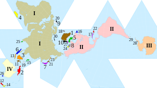
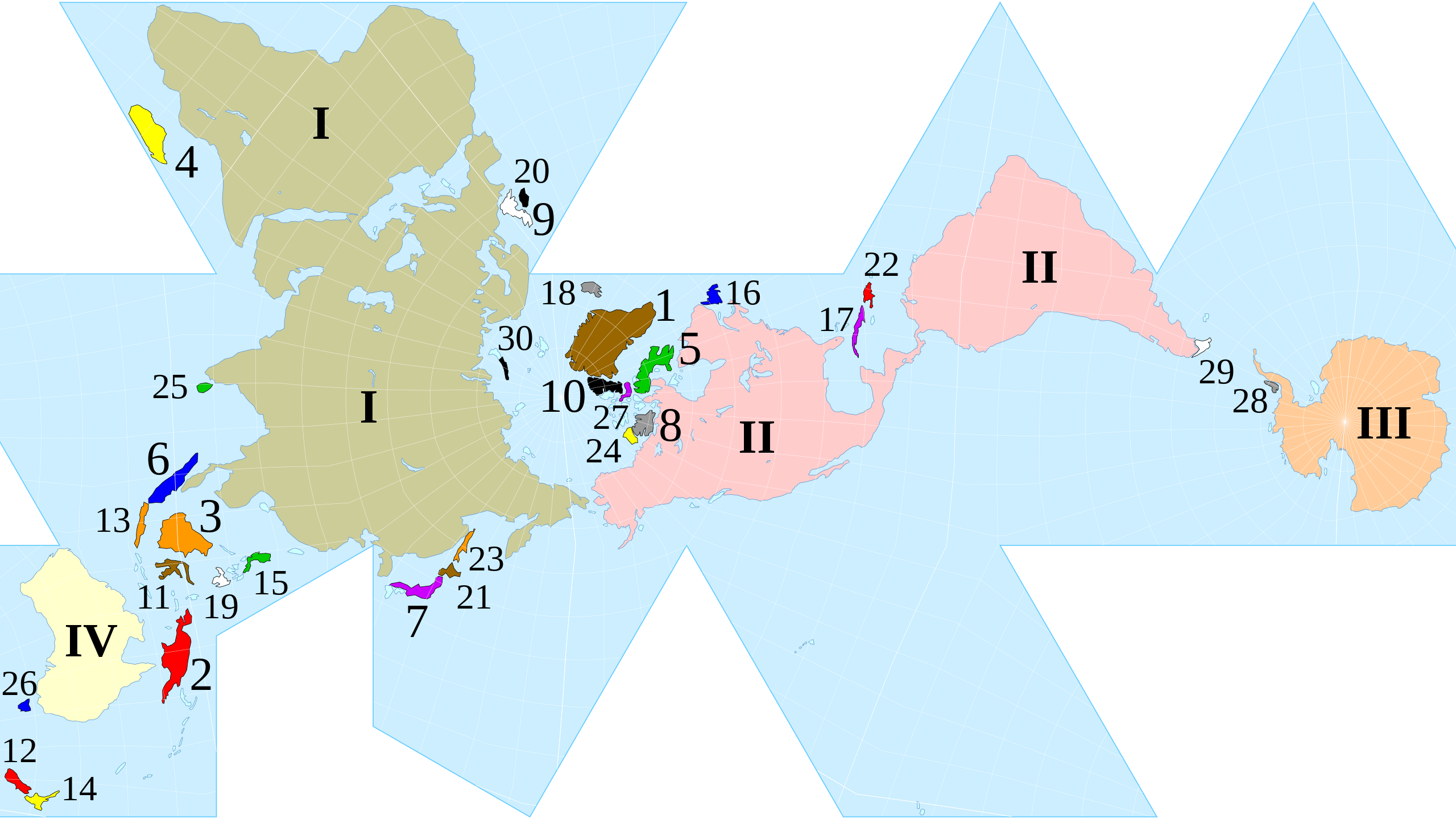
English: Dymaxion map of the world with the continental landmasses (Roman numerals) and 30 largest islands (Hindu-Arabic numerals) highlighted. (The list stops at 30 as the next few islands are north of Canada, and space is insufficient for their labels.) |
|||
| 日期 | ||||
| 來源 |
|
|||
| 作者 | cmglee, Justin Kunimune | |||
| 其他版本 |
|


授權條款
此檔案採用共享創意 姓名標示-相同方式分享 4.0 國際授權條款。
- 您可以自由:
- 分享 – 複製、發佈和傳播本作品
- 重新修改 – 創作演繹作品
- 惟需遵照下列條件:
- 姓名標示 – 您必須指名出正確的製作者,和提供授權條款的連結,以及表示是否有對內容上做出變更。您可以用任何合理的方式來行動,但不得以任何方式表明授權條款是對您許可或是由您所使用。
- 相同方式分享 – 如果您利用本素材進行再混合、轉換或創作,您必須基於如同原先的相同或兼容的條款,來分布您的貢獻成品。
檔案歷史
點選日期/時間以檢視該時間的檔案版本。
| 日期/時間 | 縮圖 | 尺寸 | 用戶 | 備註 | |
|---|---|---|---|---|---|
| 目前 | 2020年10月25日 (日) 00:15 | | 512 × 288(554 KB) | Cmglee | Uploaded a work by cmglee, Justin Kunimune from {{source thumb|Dymaxion_with_Tissot's_Indicatrices_of_Distortion.svg}} with UploadWizard |
檔案用途
下列頁面有用到此檔案:
全域檔案使用狀況
以下其他 wiki 使用了這個檔案:
- en.wikipedia.org 的使用狀況
- fa.wikipedia.org 的使用狀況
- hi.wikipedia.org 的使用狀況
- kk.wikipedia.org 的使用狀況
- si.wikipedia.org 的使用狀況