File:Ladakh locator map.svg

此 SVG 檔案的 PNG 預覽的大小:764 × 600 像素。 其他解析度:306 × 240 像素 | 611 × 480 像素 | 978 × 768 像素 | 1,280 × 1,005 像素 | 2,560 × 2,010 像素 | 2,160 × 1,696 像素。
原始檔案 (SVG 檔案,表面大小:2,160 × 1,696 像素,檔案大小:202 KB)
| 標題 |
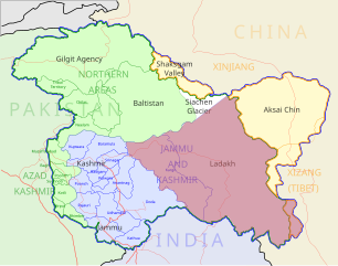
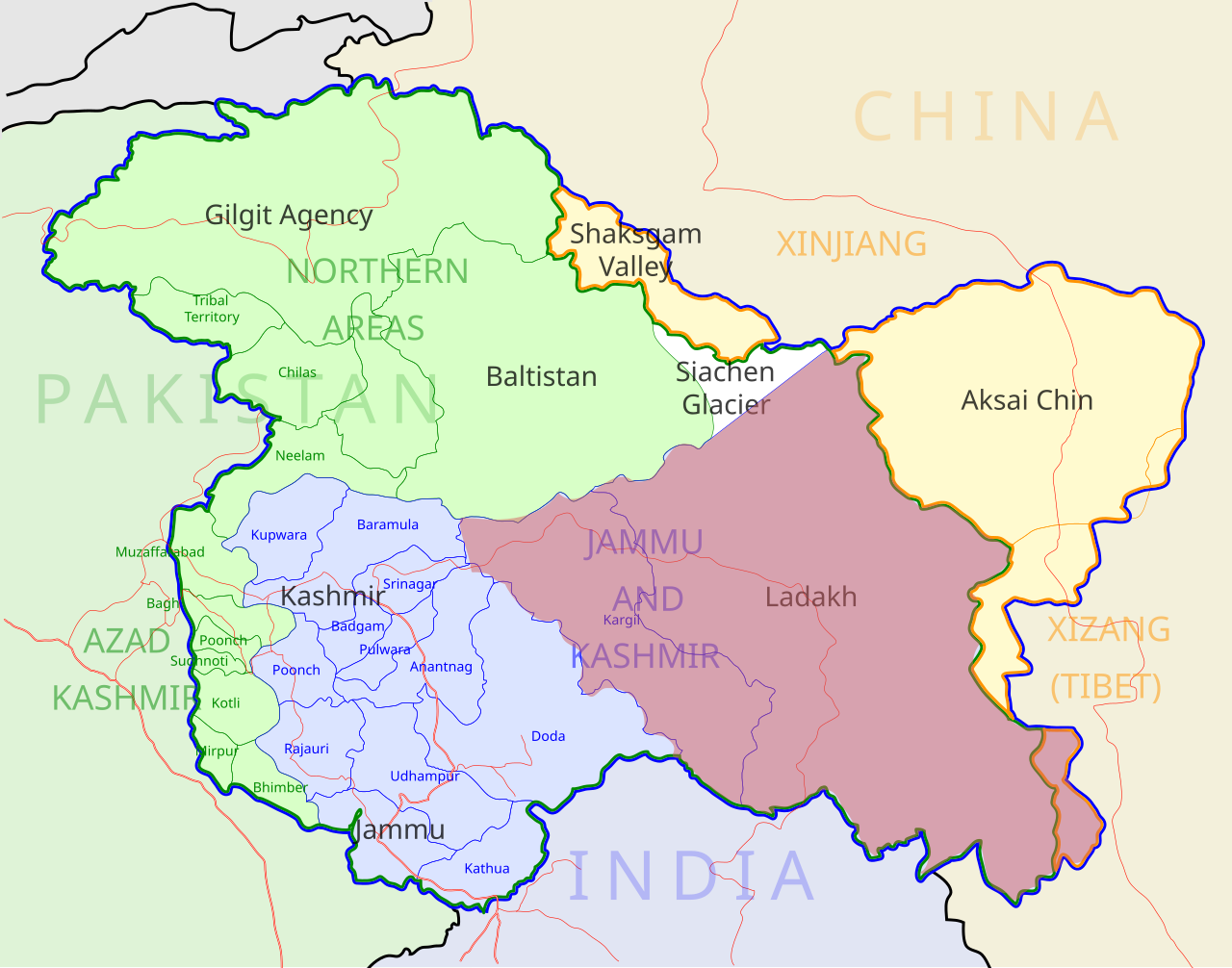
Ladakh locator map |
| 描寫 |
Locator map for the region of w:Ladakh (higlighted in red) in the w:Indian state of w:Jammu and Kashmir |
| 日期 | |
| 來源 |
自己的作品 |
| 創作作者 | |
| 授權許可 (重用此檔案) |
我,本作品的著作權持有者,決定用以下授權條款發佈本作品: 此檔案採用共享創意 姓名標示-相同方式分享 3.0 未在地化版本授權條款。
|
| Geotemporal data | |
| 描繪日期 | 20世紀下半期和21世紀 |
| 地理參考 | 如果不合適,請設定「warp_status = skip」為隱藏。 |
| Archival data | |
| 備註 | Part of WikiProject India Maps |
檔案歷史
點選日期/時間以檢視該時間的檔案版本。
| 日期/時間 | 縮圖 | 尺寸 | 用戶 | 備註 | |
|---|---|---|---|---|---|
| 目前 | 2012年12月2日 (日) 05:50 | | 2,160 × 1,696(202 KB) | Baomi | 改“XIJANG”为“XIZANG” |
| 2007年5月10日 (四) 00:24 |  | 2,160 × 1,696(260 KB) | Saravask | {{WikiProject_India_Maps |Title=Ladakh locator map |Description=Locator map for the region of w:Ladakh (higlighted in red) in the w:Indian state of [w:Jammu and Kashmir]] |Source= [http://www.koausa.org/Nature/maps.html Map of Kashmir], |Date=May |
檔案用途
下列頁面有用到此檔案:
全域檔案使用狀況
以下其他 wiki 使用了這個檔案:
- as.wikipedia.org 的使用狀況
- awa.wikipedia.org 的使用狀況
- bpy.wikipedia.org 的使用狀況
- ceb.wikipedia.org 的使用狀況
- en.wikipedia.org 的使用狀況
- fa.wikipedia.org 的使用狀況
- he.wikipedia.org 的使用狀況
- hi.wikipedia.org 的使用狀況
- hu.wikipedia.org 的使用狀況
- incubator.wikimedia.org 的使用狀況
- it.wikipedia.org 的使用狀況
- it.wikivoyage.org 的使用狀況
- ja.wikipedia.org 的使用狀況
- ko.wikipedia.org 的使用狀況
- mai.wikipedia.org 的使用狀況
- ml.wikipedia.org 的使用狀況
- nn.wikipedia.org 的使用狀況
- no.wikipedia.org 的使用狀況
- or.wikipedia.org 的使用狀況
- pam.wikipedia.org 的使用狀況
檢視此檔案的更多全域使用狀況。