File:Michigan Central Railroad system map (1918).svg

此 SVG 檔案的 PNG 預覽的大小:800 × 457 像素。 其他解析度:320 × 183 像素 | 640 × 366 像素 | 1,024 × 585 像素 | 1,280 × 731 像素 | 2,560 × 1,463 像素 | 1,120 × 640 像素。
原始檔案 (SVG 檔案,表面大小:1,120 × 640 像素,檔案大小:6.5 MB)
.svg?uselang=zh-hk)
.svg?uselang=zh-hk)
.svg?action=history&uselang=zh-hk)
.svg)
摘要
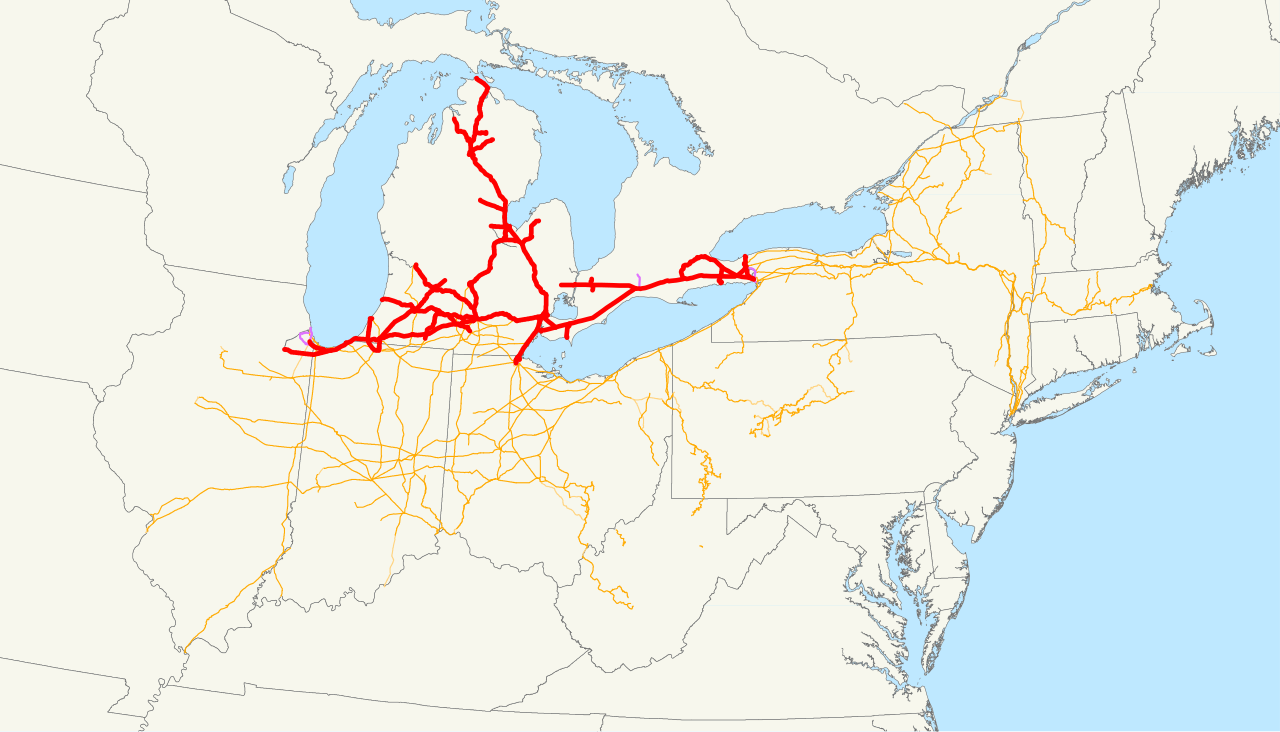
| 描述 | This is a map of the Michigan Central Railroad drawn on the New York Central system as of 1918, with trackage rights in purple. Email me if you would like a copy of the GIS data I created (modified from Bureau of Transportation Statistics North American Transportation Atlas Data) or if you see any errors. |
| 日期 | 2008年十一月13日 (原始上傳日期) |
| 來源 | 无法识别来源。根据版权声明推断为其自己的作品。 |
| 作者 | 无法识别作者。根据版权声明推断作者为NE2。 |
授權條款
| 我,此作品的版權所有人,釋出此作品至公共領域。此授權條款在全世界均適用。 這可能在某些國家不合法,如果是的話: 我授予任何人有權利使用此作品於任何用途,除受法律約束外,不受任何限制。 |
檔案歷史
點選日期/時間以檢視該時間的檔案版本。
| 日期/時間 | 縮圖 | 尺寸 | 用戶 | 備註 | |
|---|---|---|---|---|---|
| 目前 | 2008年11月13日 (四) 16:11 | | 1,120 × 640(6.5 MB) | NE2 | == Summary == This is a map of the Michigan Central Railroad drawn on the New York Central system as of 1918, with trackage rights in purple. Email me if you would like a copy of the GIS data I created (mod |
檔案用途
下列頁面有用到此檔案:
全域檔案使用狀況
以下其他 wiki 使用了這個檔案:
- de.wikipedia.org 的使用狀況
- fr.wikipedia.org 的使用狀況
- www.wikidata.org 的使用狀況
.svg)