File:Plateau communes.png
預覽大小:776 × 600 像素。 其他解析度:311 × 240 像素 | 621 × 480 像素 | 994 × 768 像素 | 1,056 × 816 像素。
原始檔案 (1,056 × 816 像素,檔案大小:27 KB,MIME 類型:image/png)
摘要
| 描述 |
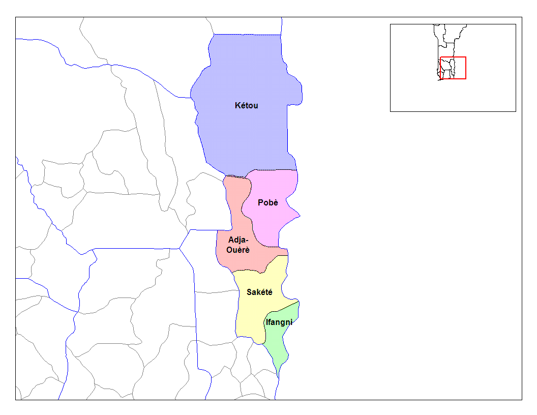
English: Map of the communes of the department of Plateau, Benin. Created by Rarelibra for public domain use. Created using MapInfo Professional v7.5 and various mapping resources. |
| 日期 | 2006年三月5日 (原始上傳日期) |
| 來源 | Transferred from en.wikipedia to Commons. |
| 作者 | 英文維基百科的Rarelibra |
授權條款
| 此作品已由其作者,英文維基百科的Rarelibra,釋出至公有領域。此授權條款在全世界均適用。 這可能在某些國家不合法,如果是的話: Rarelibra授予任何人有權利使用此作品於任何用途,除受法律約束外,不受任何限制。 |
原始上傳日誌
The original description page was here. All following user names refer to en.wikipedia.
- 2006-03-05 02:58 Rarelibra 1056×816× (27153 bytes) Map of the communes of the department of Plateau, Benin. Created by Rarelibra for public domain use. Created using MapInfo Professional v7.5 and various mapping resources.
檔案歷史
點選日期/時間以檢視該時間的檔案版本。
| 日期/時間 | 縮圖 | 尺寸 | 用戶 | 備註 | |
|---|---|---|---|---|---|
| 目前 | 2010年4月28日 (三) 10:37 | | 1,056 × 816(27 KB) | Deadstar | larger size file from en: wiki |
| 2007年2月17日 (六) 15:16 |  | 776 × 600(112 KB) | Reyos | from http://en.wikipedia.org/wiki/Image:Plateau_communes.png |
檔案用途
下列頁面有用到此檔案:
全域檔案使用狀況
以下其他 wiki 使用了這個檔案:
- ar.wikipedia.org 的使用狀況
- ca.wikipedia.org 的使用狀況
- ceb.wikipedia.org 的使用狀況
- de.wikipedia.org 的使用狀況
- en.wikipedia.org 的使用狀況
- eo.wikipedia.org 的使用狀況
- es.wikipedia.org 的使用狀況
- fi.wikipedia.org 的使用狀況
- frr.wikipedia.org 的使用狀況
- fr.wikipedia.org 的使用狀況
- ha.wikipedia.org 的使用狀況
- hu.wikipedia.org 的使用狀況
- id.wikipedia.org 的使用狀況
- ig.wikipedia.org 的使用狀況
- it.wikipedia.org 的使用狀況
- ja.wikipedia.org 的使用狀況
- lt.wikipedia.org 的使用狀況
- nl.wikipedia.org 的使用狀況
- pt.wikipedia.org 的使用狀況
- ro.wikipedia.org 的使用狀況
- sv.wikipedia.org 的使用狀況
- sw.wikipedia.org 的使用狀況
- tr.wikipedia.org 的使用狀況
- ts.wikipedia.org 的使用狀況
檢視此檔案的更多全域使用狀況。