File:Spice Islands-Zanzibar highlighted-fr.svg

此 SVG 檔案的 PNG 預覽的大小:486 × 599 像素。 其他解析度:195 × 240 像素 | 389 × 480 像素 | 623 × 768 像素 | 831 × 1,024 像素 | 1,661 × 2,048 像素 | 713 × 879 像素。
原始檔案 (SVG 檔案,表面大小:713 × 879 像素,檔案大小:24 KB)
摘要
| 描述 |
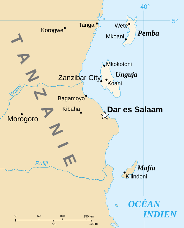
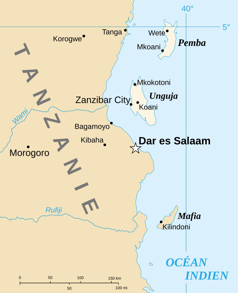
English: Part of the map of Tanzania in French, showing the Spice Islands. Français : Détail de la carte de Tanzanie en français montrant l'archipel de Zanzibar. |
| 日期 | of the translation : July 2007 |
| 來源 | Image:Spice Islands (Zanzibar highlighted).svg created by Mysid |
| 作者 | of the translation : Sting |
| 授權許可 (重用此檔案) |
PD |
| 其他版本 |
Image:Spice_Islands_Tanzania-fr.svg in English : Image:Spice Islands (Tanzania).svg in English : Image:Spice Islands (Zanzibar highlighted).svg |
.svg)
.svg)

|
This SVG file contains embedded text that can be translated into your language, using any capable SVG editor, text editor or the SVG Translate tool. For more information see: About translating SVG files. |
授權條款
| 我,此作品的版權所有人,釋出此作品至公共領域。此授權條款在全世界均適用。 這可能在某些國家不合法,如果是的話: 我授予任何人有權利使用此作品於任何用途,除受法律約束外,不受任何限制。 |
| This work was previously under Public Domain, or a Free License. It has been digitally enhanced and/or modified. This derivative work has been (or is hereby) released into the public domain by its author, Sting at the French Wikipedia project. This applies worldwide. 在一些國家這可能不合法;如果是這樣的話,那麼:
|
檔案歷史
點選日期/時間以檢視該時間的檔案版本。
| 日期/時間 | 縮圖 | 尺寸 | 用戶 | 備註 | |
|---|---|---|---|---|---|
| 目前 | 2007年7月6日 (五) 13:31 | | 713 × 879(24 KB) | Sting | {{Information |Description={{en|Part of the map of Tanzania in French, showing the Spice Islands.}}{{fr|Détail de la carte de Tanzanie en français montrant l'archipel de Zanzibar.}} |Source=[[:Image:Spice |
檔案用途
下列頁面有用到此檔案:
全域檔案使用狀況
以下其他 wiki 使用了這個檔案:
- el.wikipedia.org 的使用狀況
- en.wikipedia.org 的使用狀況
- es.wikipedia.org 的使用狀況
- fr.wikipedia.org 的使用狀況
- uk.wikipedia.org 的使用狀況