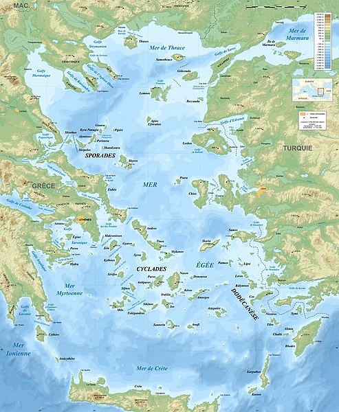
File:Aegean Sea map bathymetry-fr.jpg

預覽大小:493 × 600 像素。 其他解析度:197 × 240 像素 | 395 × 480 像素 | 631 × 768 像素 | 842 × 1,024 像素 | 1,684 × 2,048 像素 | 3,744 × 4,554 像素。
原始檔案 (3,744 × 4,554 像素,檔案大小:4.22 MB,MIME 類型:image/jpeg)
檔案歷史
點選日期/時間以檢視該時間的檔案版本。
| 日期/時間 | 縮圖 | 尺寸 | 用戶 | 備註 | |
|---|---|---|---|---|---|
| 目前 | 2010年7月17日 (六) 21:52 |  | 3,744 × 4,554(4.22 MB) | Sting | Color profile |
| 2010年6月15日 (二) 19:10 |  | 3,744 × 4,554(5.36 MB) | Ras67 | cropped | |
| 2009年2月12日 (四) 19:35 |  | 3,750 × 4,560(2.74 MB) | Sting | == Summary == {{Location|38|00|00|N|25|00|00|E|scale:3000000}} <br/> {{Information |Description={{en|Bathymetric map in French of the Aegean Sea, Mediterranean Sea.}} {{fr|Carte bathymétrique en français de la [[:Category:Aegean |
檔案用途
下列40個頁面有用到此檔案:
全域檔案使用狀況
以下其他 wiki 使用了這個檔案:
- an.wikipedia.org 的使用狀況
- bg.wikipedia.org 的使用狀況
- bs.wikipedia.org 的使用狀況
- cs.wikipedia.org 的使用狀況
- de.wikipedia.org 的使用狀況
- en.wikiversity.org 的使用狀況
- eo.wikipedia.org 的使用狀況
- es.wikipedia.org 的使用狀況
- fr.wikipedia.org 的使用狀況
- fr.wiktionary.org 的使用狀況
- hyw.wikipedia.org 的使用狀況
- id.wikibooks.org 的使用狀況
- ilo.wikipedia.org 的使用狀況
- incubator.wikimedia.org 的使用狀況
- ja.wikipedia.org 的使用狀況
檢視此檔案的更多全域使用狀況。


