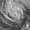
File:Barbara 2001-06-21 1530Z.jpg

預覽大小:600 × 600 像素。 其他解析度:240 × 240 像素 | 480 × 480 像素 | 900 × 900 像素。
原始檔案 (900 × 900 像素,檔案大小:258 KB,MIME 類型:image/jpeg)
檔案歷史
點選日期/時間以檢視該時間的檔案版本。
| 日期/時間 | 縮圖 | 尺寸 | 用戶 | 備註 | |
|---|---|---|---|---|---|
| 目前 | 2023年9月20日 (三) 23:17 |  | 900 × 900(258 KB) | Nino Marakot | Reverted to version as of 04:58, 19 September 2006 (UTC) |
| 2010年11月24日 (三) 04:25 |  | 674 × 573(82 KB) | 12george1 | Added nicer looking picture of Tropical Storm Barbara from OSEI | |
| 2006年9月19日 (二) 04:58 |  | 900 × 900(258 KB) | Good kitty | == Summary == {{Information |Description=This image of Tropical Storm Barbara was captured by the GOES-10 satellite on June 21, 2001 at 1530 UTC. Barbara was located south of Mexico with peak intensity winds of 60 mph and a minimum pressure of 997 mb. |So |
檔案用途
下列頁面有用到此檔案:

