File:Canton River and adjacent islands.jpg

預覽大小:632 × 599 像素。 其他解析度:253 × 240 像素 | 506 × 480 像素 | 810 × 768 像素 | 1,080 × 1,024 像素 | 2,160 × 2,048 像素 | 4,952 × 4,695 像素。
原始檔案 (4,952 × 4,695 像素,檔案大小:5.44 MB,MIME 類型:image/jpeg)
摘要
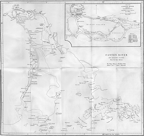
| 描述 | Map of the Canton River and adjacent islands. The inset shows the position of British ships comprising the advanced squadron on 26 May 1841. |
| 日期 | published 1844 |
| 來源 | William Dallas Bernard; William Hutcheon Hall (1844). Narrative of the Voyages and Services of the Nemesis, from 1840 to 1843. Volume 1. London: Henry Colburn. |
| 作者 | Isaac Purdy |
| 其他版本 | File:Map of Canton River.jpg |
授權條款
|
本作品在其來源國以及其他版權期限是作者逝世後100年或以下的國家與地區屬於公有領域。 | |
| 此作品無已知的著作權限制,亦不受所有相關和鄰接的權利限制。 | |
檔案歷史
點選日期/時間以檢視該時間的檔案版本。
| 日期/時間 | 縮圖 | 尺寸 | 用戶 | 備註 | |
|---|---|---|---|---|---|
| 目前 | 2010年10月31日 (日) 13:23 | | 4,952 × 4,695(5.44 MB) | Spellcast | == {{int:filedesc}} == {{Information |Description=Map of the Canton River and adjacent islands. |Date=Published 1844 |Source=William Dallas Bernard; William Hutcheon Hall (1844). ''[http://www.elibron.com/maps/?msg_id=172640 Narrative of the Voyages and S |
檔案用途
下列頁面有用到此檔案:
全域檔案使用狀況
以下其他 wiki 使用了這個檔案:
- azb.wikipedia.org 的使用狀況
- ca.wikipedia.org 的使用狀況
- en.wikipedia.org 的使用狀況
- fr.wikipedia.org 的使用狀況
- id.wikipedia.org 的使用狀況
- vi.wikipedia.org 的使用狀況
- zh-yue.wikipedia.org 的使用狀況