File:DavidsonTrig.jpg

預覽大小:479 × 599 像素。 其他解析度:192 × 240 像素 | 384 × 480 像素 | 718 × 898 像素。
原始檔案 (718 × 898 像素,檔案大小:59 KB,MIME 類型:image/jpeg)
| 描述 |
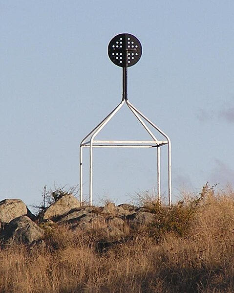
English: Davidson en:Trig point on en:Red Hill, Australian Capital Territory.
From ACT Govt info on Survey Control Marks - In the ACT trig stations consist of a ground mark with a white quadripod supporting a black disc above the ground mark. Most of these Trig Stations are part of the ACT Precision Zone: a national geodetic survey and adjustment carried out in the early 1970s. The ACT Precision Zone and its associated marks have been the primary control for all new development in the ACT since the early 1970s. The accuracy of ACT Precision Zone marks is 1 in 250,000. Further information on Geodetic survey in Australia - now and history. |
| 日期 | 2005年五月2日 (原始上傳日期) |
| 來源 | Transferred from en.wikipedia to Commons by Bidgee using CommonsHelper. |
| 作者 | 英文維基百科的Matilda |
| 授權許可 (重用此檔案) |
PD-USER-W|EN|WIKIPEDIA. |
授權條款
| 此作品已由其作者,英文維基百科的AYArktos,釋出至公有領域。此授權條款在全世界均適用。 這可能在某些國家不合法,如果是的話: AYArktos授予任何人有權利使用此作品於任何用途,除受法律約束外,不受任何限制。 |
原始上傳日誌
The original description page was here. All following user names refer to en.wikipedia.
- 2005-05-02 00:25 Matilda 718×898× (60281 bytes) Davidson [[Trig point]] on [[Red Hill, Australian Capital Territory]]. From [http://www.actpla.act.gov.au/actlic/surveycontrolmarks/ ACT Govt info on Survey Control Marks] - In the ACT trig stations consist of a ground mark with a white quadripod support
檔案歷史
點選日期/時間以檢視該時間的檔案版本。
| 日期/時間 | 縮圖 | 尺寸 | 用戶 | 備註 | |
|---|---|---|---|---|---|
| 目前 | 2009年1月3日 (六) 01:59 | | 718 × 898(59 KB) | Bidgee | {Information |Description={{en|Davidson en:Trig point on en:Red Hill, Australian Capital Territory. From [http://www.actpla.act.gov.au/actlic/surveycontrolmarks/ ACT Govt info on Survey Control Marks] - In the ACT trig stations consist of |
檔案用途
下列頁面有用到此檔案:
全域檔案使用狀況
以下其他 wiki 使用了這個檔案:
- en.wikipedia.org 的使用狀況
- eo.wikipedia.org 的使用狀況
- ja.wikipedia.org 的使用狀況