File:Golan heights border.jpg

預覽大小:800 × 600 像素。 其他解析度:320 × 240 像素 | 640 × 480 像素 | 1,024 × 768 像素 | 1,280 × 960 像素 | 2,304 × 1,728 像素。
原始檔案 (2,304 × 1,728 像素,檔案大小:625 KB,MIME 類型:image/jpeg)
摘要
| 描述 |
Čeština: hranice mezi izraelem a sýrií v golanských výšinách
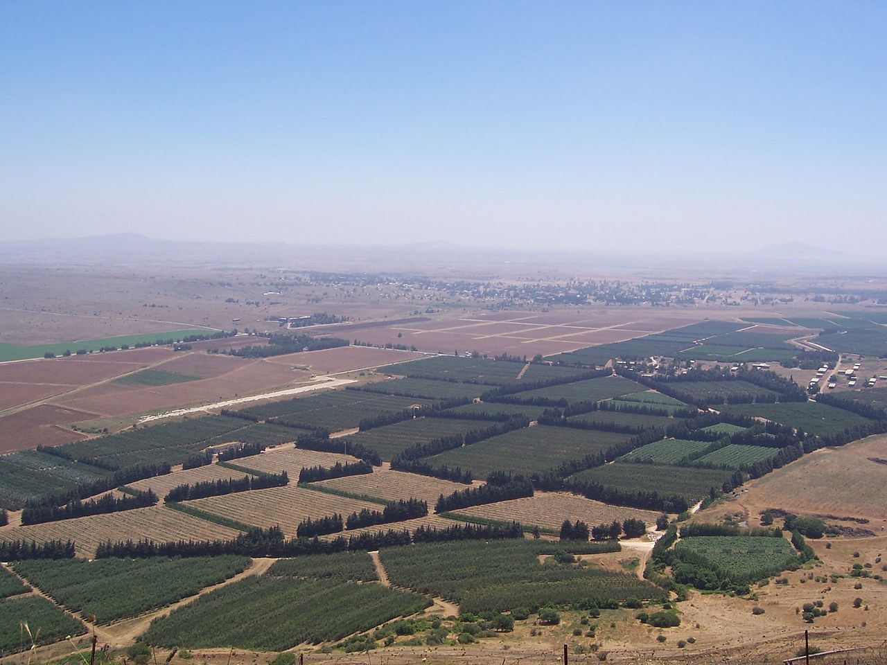
English: The Golan Heights' border with Syria proper. The Golan Heights end (and Syria begins) where the farmland ends. In the background is the deserted city of Quneitra in Syria. The white buildings on the right are mostly UN buildings.
Русский: Сирийско-израильская граница в Голанских высотах
Français : Vue sur la frontière syro-israélienne à la lisière des hauteurs du Golan. On distingue au loin la ville syrienne de Quneitra désertée. Les bâtiments de couleur claire à droite appartiennent pour la plupart à l'ONU. |
| 日期 | 攝於2004年 |
| 來源 | 自行拍攝 (Original text: I took this picture.) |
| 作者 | Masterpjz9 at en.wikipedia |
授權條款
此檔案採用創用CC 姓名標示-相同方式分享 2.5 通用版授權條款。
- 您可以自由:
- 分享 – 複製、發佈和傳播本作品
- 重新修改 – 創作演繹作品
- 惟需遵照下列條件:
- 姓名標示 – 您必須指名出正確的製作者,和提供授權條款的連結,以及表示是否有對內容上做出變更。您可以用任何合理的方式來行動,但不得以任何方式表明授權條款是對您許可或是由您所使用。
- 相同方式分享 – 如果您利用本素材進行再混合、轉換或創作,您必須基於如同原先的相同或兼容的條款,來分布您的貢獻成品。
原始上傳日誌
The original description page was here. All following user names refer to en.wikipedia.
- 2006-04-08 03:29 Masterpjz9 2304×1728× (639949 bytes) This is a photo of the Israeli Golan Heights border with Syria. The Golan Heights end (and Syria begins) where the farmland ends. In the background there is an deserted city of Syria, and the white buildings in the right are mostly UN buildings. I took t
檔案歷史
點選日期/時間以檢視該時間的檔案版本。
| 日期/時間 | 縮圖 | 尺寸 | 用戶 | 備註 | |
|---|---|---|---|---|---|
| 目前 | 2012年4月10日 (二) 02:45 | | 2,304 × 1,728(625 KB) | OgreBot | (BOT): Uploading old version of file from en.wikipedia; originally uploaded on 2006-04-08 03:29:30 by Masterpjz9 |
| 2006年7月31日 (一) 21:09 |  | 800 × 600(69 KB) | Becherka | Israeli golan heights border with syria hranice mezi izraelem a sýrií v golanských výšinách |
檔案用途
下列頁面有用到此檔案:
全域檔案使用狀況
以下其他 wiki 使用了這個檔案:
- ar.wikipedia.org 的使用狀況
- be-tarask.wikipedia.org 的使用狀況
- ca.wikipedia.org 的使用狀況
- ckb.wikipedia.org 的使用狀況
- en.wikipedia.org 的使用狀況
- fa.wikipedia.org 的使用狀況
- fr.wikipedia.org 的使用狀況
- he.wikipedia.org 的使用狀況
- hu.wikipedia.org 的使用狀況
- id.wikipedia.org 的使用狀況
- ja.wikipedia.org 的使用狀況
- ko.wikipedia.org 的使用狀況
- ms.wikipedia.org 的使用狀況
- mzn.wikipedia.org 的使用狀況
- nl.wikipedia.org 的使用狀況
- pt.wikipedia.org 的使用狀況
- ru.wikipedia.org 的使用狀況
- tg.wikipedia.org 的使用狀況
- tr.wikipedia.org 的使用狀況
- vi.wikipedia.org 的使用狀況
- www.wikidata.org 的使用狀況