File:Israel outline northeast.png

預覽大小:699 × 600 像素。 其他解析度:280 × 240 像素 | 560 × 480 像素 | 732 × 628 像素。
原始檔案 (732 × 628 像素,檔案大小:110 KB,MIME 類型:image/png)
摘要
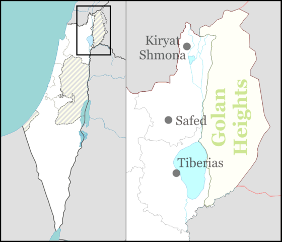
| 描述 | Northeastern Israel and the Golan Heights for location maps. |
| 日期 | |
| 來源 | 自己的作品 |
| 作者 | Ynhockey |
| 其他版本 | العربيَّة |
授權條款
我,本作品的著作權持有者,決定用以下授權條款發佈本作品:
此檔案採用共享創意 姓名標示-相同方式分享 3.0 未在地化版本授權條款。
- 您可以自由:
- 分享 – 複製、發佈和傳播本作品
- 重新修改 – 創作演繹作品
- 惟需遵照下列條件:
- 姓名標示 – 您必須指名出正確的製作者,和提供授權條款的連結,以及表示是否有對內容上做出變更。您可以用任何合理的方式來行動,但不得以任何方式表明授權條款是對您許可或是由您所使用。
- 相同方式分享 – 如果您利用本素材進行再混合、轉換或創作,您必須基於如同原先的相同或兼容的條款,來分布您的貢獻成品。

|
已授權您依據自由軟體基金會發行的無固定段落、封面文字和封底文字GNU自由文件授權條款1.2版或任意後續版本,對本檔進行複製、傳播和/或修改。該協議的副本列在GNU自由文件授權條款中。 |
您可以選擇您需要的授權條款。
檔案歷史
點選日期/時間以檢視該時間的檔案版本。
| 日期/時間 | 縮圖 | 尺寸 | 用戶 | 備註 | |
|---|---|---|---|---|---|
| 目前 | 2016年9月1日 (四) 17:30 | | 732 × 628(110 KB) | Number 57 | Updated Israel map |
| 2009年3月16日 (一) 00:31 |  | 732 × 628(35 KB) | Ynhockey | {{Information |Description=Northeastern Israel and the Golan Heights for location maps. |Source=self-made |Date=2009-03-12 |Author= Ynhockey |Permission= |other_versions= }} Category:Maps of Israel |
檔案用途
下列頁面有用到此檔案:
全域檔案使用狀況
以下其他 wiki 使用了這個檔案:
- ca.wikipedia.org 的使用狀況
- de.wikipedia.org 的使用狀況
- de.wikivoyage.org 的使用狀況
- el.wikipedia.org 的使用狀況
- en.wikipedia.org 的使用狀況
- Tiberias
- Safed
- Kiryat Shmona
- Hatzor HaGlilit
- Bethsaida
- Tel Hazor
- Avivim school bus bombing
- Kiryat Shmona massacre
- Degania Alef
- Lake Ram
- Kfar Tavor
- Kfar Blum
- Afik
- Sasa, Israel
- Odem
- Afikim
- Meron, Israel
- Ein Gev
- Dishon
- Margaliot
- Buq'ata
- El Rom
- Metula
- Or HaGanuz
- Kedesh
- Rosh Pinna
- Migdal, Israel
- Sha'ar HaGolan
- Dan, Israel
- Manara, Israel
- Amirim
- Mount Arbel
- Kfar Kama
- Avnei Eitan
- Kiryat Shmona Airport
- Rosh Pina Airport
- Deir Hanna
- Shamir, Israel
- Kfar Giladi
- HaOn
- Kfar Szold
- Yesud HaMa'ala
檢視此檔案的更多全域使用狀況。