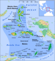
File:Maluku Islands en.png

預覽大小:544 × 599 像素。 其他解析度:218 × 240 像素 | 436 × 480 像素 | 697 × 768 像素 | 930 × 1,024 像素 | 1,489 × 1,640 像素。
原始檔案 (1,489 × 1,640 像素,檔案大小:1.08 MB,MIME 類型:image/png)
檔案歷史
點選日期/時間以檢視該時間的檔案版本。
| 日期/時間 | 縮圖 | 尺寸 | 用戶 | 備註 | |
|---|---|---|---|---|---|
| 目前 | 2018年2月26日 (一) 13:52 |  | 1,489 × 1,640(1.08 MB) | Sebastian Wallroth | Removed border by cropping 1 % horizontally and 1 % vertically using CropTool with precise mode. |
| 2013年3月28日 (四) 13:04 |  | 1,499 × 1,650(1.09 MB) | Lencer | + Kayoa | |
| 2013年3月24日 (日) 18:10 |  | 1,499 × 1,650(1.09 MB) | Lencer | + Manuk, + Serua, + Teun, Haruku fixed | |
| 2013年2月12日 (二) 09:45 |  | 1,500 × 1,651(1.09 MB) | Lencer | + Lease Islands | |
| 2013年2月11日 (一) 15:29 |  | 1,500 × 1,651(1.08 MB) | Lencer | == {{int:filedesc}} == {{Information |Description= {{en|Map of Maluku Islands}} |Source=own work, used: * Maluku Locator Topography.png by User:Sadalmelik |Date=2013-02 |Author=[[User:L... |
檔案用途
全域檔案使用狀況
以下其他 wiki 使用了這個檔案:
- ace.wikipedia.org 的使用狀況
- af.wikipedia.org 的使用狀況
- ar.wikipedia.org 的使用狀況
- ast.wikipedia.org 的使用狀況
- az.wikipedia.org 的使用狀況
- ba.wikipedia.org 的使用狀況
- bcl.wikipedia.org 的使用狀況
- bg.wikipedia.org 的使用狀況
- bm.wikipedia.org 的使用狀況
- bn.wikipedia.org 的使用狀況
- btm.wikipedia.org 的使用狀況
- ca.wikipedia.org 的使用狀況
- ceb.wikipedia.org 的使用狀況
檢視此檔案的更多全域使用狀況。


