File:Pinos Altos RR.jpg
此為最大尺寸。
Pinos_Altos_RR.jpg (600 × 476 像素,檔案大小:92 KB,MIME 類型:image/jpeg)
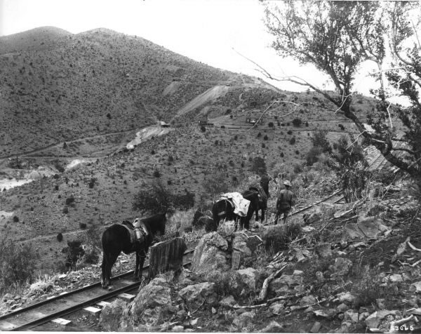
| 描述 |
English: n.d.—A narrow gauge railroad to the mines at Pinos Altos, Gila National Forest.
Photo by Unknown FS #53065 |
|||
| 日期 | 日期不明 | |||
| 來源 | http://www.fs.fed.us/r3/about/history/gila/pages/gil004_jpg.htm | |||
| 作者 | US Forest Service | |||
| 授權許可 (重用此檔案) |
|
| 目標地點 | | 位於此地的本圖片與其他圖片: OpenStreetMap |
|---|
檔案歷史
點選日期/時間以檢視該時間的檔案版本。
| 日期/時間 | 縮圖 | 尺寸 | 用戶 | 備註 | |
|---|---|---|---|---|---|
| 目前 | 2009年5月6日 (三) 03:35 | | 600 × 476(92 KB) | Tillman | {{Information |Description={{en|1=n.d.—A narrow gauge railroad to the mines at Pinos Altos. Photo by Unknown FS #53065 }} |Source=http://www.fs.fed.us/r3/about/history/gila/pages/gil004_jpg.htm |Author=US Forest Service |Date=UNK |Permission={{PD-USGov- |
檔案用途
下列頁面有用到此檔案:
全域檔案使用狀況
以下其他 wiki 使用了這個檔案:
- en.wikipedia.org 的使用狀況
- it.wikipedia.org 的使用狀況