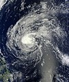
File:02w Omais Mar 25 2010 01.35(UTC).jpg

本预览的尺寸:466 × 599像素。 其他分辨率:187 × 240像素 | 373 × 480像素 | 597 × 768像素 | 796 × 1,024像素 | 1,593 × 2,048像素 | 5,600 × 7,200像素。
原始文件 (5,600 × 7,200像素,文件大小:18.44 MB,MIME类型:image/jpeg)
文件历史
点击某个日期/时间查看对应时刻的文件。
| 日期/时间 | 缩略图 | 大小 | 用户 | 备注 | |
|---|---|---|---|---|---|
| 当前 | 2019年11月1日 (五) 11:08 |  | 5,600 × 7,200(18.44 MB) | Nino Marakot | Removed bluish colors, adjusted size and centered to the exposed center |
| 2014年7月15日 (二) 15:13 |  | 7,238 × 9,609(40.33 MB) | Supportstorm | Linear projection | |
| 2013年1月29日 (二) 05:48 |  | 7,521 × 8,903(10.74 MB) | Earth100 | Fixed the over dark ocean and land. | |
| 2013年1月29日 (二) 05:42 |  | 7,521 × 8,903(10.7 MB) | Earth100 | Best Version, and image. | |
| 2013年1月9日 (三) 14:40 |  | 5,110 × 4,749(4.88 MB) | Earth100 | User created page with UploadWizard |
文件用途
以下2个页面使用本文件:
全域文件用途
以下其他wiki使用此文件:
- en.wikipedia.org上的用途
- ja.wikipedia.org上的用途
- ko.wikipedia.org上的用途
- pt.wikipedia.org上的用途
- th.wikipedia.org上的用途
- vi.wikipedia.org上的用途


