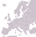
File:BlankEurope.png

本预览的尺寸:595 × 599像素。 其他分辨率:238 × 240像素 | 477 × 480像素 | 762 × 768像素 | 1,236 × 1,245像素。
原始文件 (1,236 × 1,245像素,文件大小:78 KB,MIME类型:image/png)
文件历史
点击某个日期/时间查看对应时刻的文件。
| 日期/时间 | 缩略图 | 大小 | 用户 | 备注 | |
|---|---|---|---|---|---|
| 当前 | 2022年9月26日 (一) 13:31 |  | 1,236 × 1,245(78 KB) | BlackShadowG | Reverted to version as of 14:55, 27 October 2008 (UTC) |
| 2009年2月23日 (一) 22:40 |  | 1,236 × 1,245(78 KB) | Avala | ||
| 2008年10月27日 (一) 14:55 |  | 1,236 × 1,245(78 KB) | Quilbert | Reverted to version as of 05:53, 5 April 2008 – there is already Image:BlankEurope-BeforeKosovo.png | |
| 2008年10月24日 (五) 18:13 |  | 1,236 × 1,245(78 KB) | Avala | ||
| 2008年4月5日 (六) 05:53 |  | 1,236 × 1,245(78 KB) | Hoshie | redid microstates, beefed up Spanish N. Africa, SBAs, and Gibraltar | |
| 2008年2月25日 (一) 18:42 |  | 1,236 × 1,245(78 KB) | Hoshie | fixed Gibraltar, Ceuta and Melilla, and the SBAs | |
| 2008年2月24日 (日) 02:39 |  | 1,236 × 1,245(78 KB) | Hoshie | Added Kosovo since it has been internationally recognized | |
| 2008年1月3日 (四) 22:40 |  | 1,236 × 1,245(78 KB) | Hoshie | Re-drew ESBA and WSBA with circles until I study the CIA maps, boundary between Gibraltar and Spain. | |
| 2006年11月26日 (日) 04:47 |  | 1,236 × 1,245(44 KB) | Happenstance | A blank map of Europe extracted from Image:European Union member states by number of houses.png. ~~~~ |
文件用途
没有页面使用本文件。
全域文件用途
以下其他wiki使用此文件:
- de.wiktionary.org上的用途
- hu.wikipedia.org上的用途
- incubator.wikimedia.org上的用途
- it.wiktionary.org上的用途
- sl.wiktionary.org上的用途
- uk.wikipedia.org上的用途


