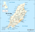
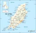
File:Isle of Man map-fr.svg

此SVG文件的PNG预览的大小:654 × 600像素。 其他分辨率:262 × 240像素 | 524 × 480像素 | 838 × 768像素 | 1,117 × 1,024像素 | 2,234 × 2,048像素 | 1,200 × 1,100像素。
原始文件 (SVG文件,尺寸为1,200 × 1,100像素,文件大小:687 KB)
文件历史
点击某个日期/时间查看对应时刻的文件。
| 日期/时间 | 缩略图 | 大小 | 用户 | 备注 | |
|---|---|---|---|---|---|
| 当前 | 2008年9月4日 (四) 14:54 |  | 1,200 × 1,100(687 KB) | Sting | New standard colors |
| 2007年5月21日 (一) 21:17 |  | 1,200 × 1,100(787 KB) | Sting | {{Information |Description=Map in French of the Isle of Man |Source=Own work ;<br/>Background map and shaded relief : [http://www2.jpl.nasa.gov/srtm NASA Shuttle Radar Topography Mission] (SRTM3 v.2) (public domain) edited with [http:/ |
文件用途
没有页面使用本文件。
全域文件用途
以下其他wiki使用此文件:
- en.wikipedia.org上的用途
- fr.wikipedia.org上的用途
- pt.wikipedia.org上的用途
- ro.wikipedia.org上的用途
- tg.wikipedia.org上的用途


