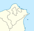
File:Taipei County Location Map.png
Taipei_County_Location_Map.png (417 × 549像素,文件大小:35 KB,MIME类型:image/png)
文件历史
点击某个日期/时间查看对应时刻的文件。
| 日期/时间 | 缩略图 | 大小 | 用户 | 备注 | |
|---|---|---|---|---|---|
| 当前 | 2009年2月28日 (六) 23:09 |  | 417 × 549(35 KB) | Esun | Reverted to version as of 03:10, 26 October 2006 |
| 2009年2月28日 (六) 21:57 |  | 123 × 112(5 KB) | Esun | A location map is used for mark a specific location within the map using coordinates. Previous image is the location of Taipei county in Taiwan map. It should be named something else, such as Taipei_County_in_Taiwan_Map. | |
| 2006年10月26日 (四) 03:10 |  | 417 × 549(35 KB) | Taiwan Junior | {{Information |Description=Location of Taipei County in Taiwan |Source=Self-made |Date=2006.10.26 |Author=Taiwan Junior |Permission= |other_versions= }} |
文件用途
以下页面使用本文件:
全域文件用途
以下其他wiki使用此文件:
- arz.wikipedia.org上的用途
- en.wikipedia.org上的用途
- es.wikipedia.org上的用途
- ja.wikipedia.org上的用途
- mt.wikipedia.org上的用途
- www.wikidata.org上的用途
- zh-min-nan.wiktionary.org上的用途


