File:Azerbaijan location map.svg

此 SVG 檔案的 PNG 預覽的大小:512 × 392 像素。 其他解析度:314 × 240 像素 | 627 × 480 像素 | 1,003 × 768 像素 | 1,280 × 980 像素 | 2,560 × 1,960 像素。
原始檔案 (SVG 檔案,表面大小:512 × 392 像素,檔案大小:156 KB)
摘要
| 描述 |
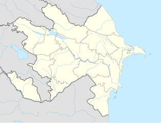
English: Location map of Azerbaijan. Borders of 1994-2020
Equirectangular projection. Strechted by 131.0%. Geographic limits of the map: * N: 42.0° N * S: 38.2° N * W: 44.5° E * E: 51.0° EMade with Natural Earth. Free vector and raster map data @ naturalearthdata.com. |
| 日期 | |
| 來源 | 自己的作品 |
| 作者 | Uwe Dedering, Don-kun |
| 其他版本 |
|


授權條款
我,本作品的著作權持有者,決定用以下授權條款發佈本作品:
此檔案採用創用CC 姓名標示-相同方式分享 3.0 未在地化版本授權條款。
- 您可以自由:
- 分享 – 複製、發佈和傳播本作品
- 重新修改 – 創作演繹作品
- 惟需遵照下列條件:
- 姓名標示 – 您必須指名出正確的製作者,和提供授權條款的連結,以及表示是否有對內容上做出變更。您可以用任何合理的方式來行動,但不得以任何方式表明授權條款是對您許可或是由您所使用。
- 相同方式分享 – 如果您利用本素材進行再混合、轉換或創作,您必須基於如同原先的相同或兼容的條款,來分布您的貢獻成品。

|
已授權您依據自由軟體基金會發行的無固定段落、封面文字和封底文字GNU自由文件授權條款1.2版或任意後續版本,對本檔進行複製、傳播和/或修改。該協議的副本列在GNU自由文件授權條款中。 |
您可以選擇您需要的授權條款。
檔案歷史
點選日期/時間以檢視該時間的檔案版本。
| 日期/時間 | 縮圖 | 尺寸 | 使用者 | 備註 | |
|---|---|---|---|---|---|
| 目前 | 2024年1月10日 (三) 16:48 | | 512 × 392(156 KB) | Janitoalevic | Economic Regions |
| 2016年5月5日 (四) 08:09 |  | 1,200 × 919(227 KB) | Rs4815 | Reverted to version as of 16:20, 21 April 2016 (UTC) | |
| 2016年5月3日 (二) 22:22 |  | 1,200 × 919(217 KB) | Taron Saharyan | нет достоверных данных, вы переместили границу на 1 км. чуть ли не по всей линии, это бред | |
| 2016年4月21日 (四) 16:20 |  | 1,200 × 919(227 KB) | Don-kun | fix karabakh border | |
| 2016年4月17日 (日) 09:46 |  | 1,200 × 919(227 KB) | Don-kun | fix border to karabakh | |
| 2016年4月13日 (三) 16:46 |  | 1,200 × 919(217 KB) | Don-kun | Jojug Marjanli now to Azerbaijan (region seemed to be a bit wrong before ...) and tried to fix some other parts of NKR-AZ-Border | |
| 2010年6月7日 (一) 19:43 |  | 1,200 × 919(217 KB) | Don-kun | correct borders of rayons; hole area under karabakh control, not the former Nagorno-Karabakh Autonomous Oblast | |
| 2010年2月19日 (五) 13:11 |  | 1,200 × 919(244 KB) | Uwe Dedering | Nagorno-Karabakh not grey, but visible | |
| 2010年2月18日 (四) 17:58 |  | 1,200 × 919(244 KB) | Uwe Dedering | but really with dagestan | |
| 2010年2月18日 (四) 17:42 |  | 1,200 × 919(233 KB) | Uwe Dedering | Dagestan and parts of Armenia saved from drowning, Nagorno-Karabakh now under the region-borders. |
檔案用途
沒有使用此檔案的頁面。
全域檔案使用狀況
以下其他 wiki 使用了這個檔案:
- bn.wikipedia.org 的使用狀況
- ckb.wikipedia.org 的使用狀況
- de.wikipedia.org 的使用狀況
- fy.wikipedia.org 的使用狀況
- he.wikipedia.org 的使用狀況