File:Bayarea map.png

預覽大小:533 × 600 像素。 其他解析度:213 × 240 像素 | 426 × 480 像素 | 682 × 768 像素 | 910 × 1,024 像素 | 1,539 × 1,732 像素。
原始檔案 (1,539 × 1,732 像素,檔案大小:475 KB,MIME 類型:image/png)
摘要
| 描述 |
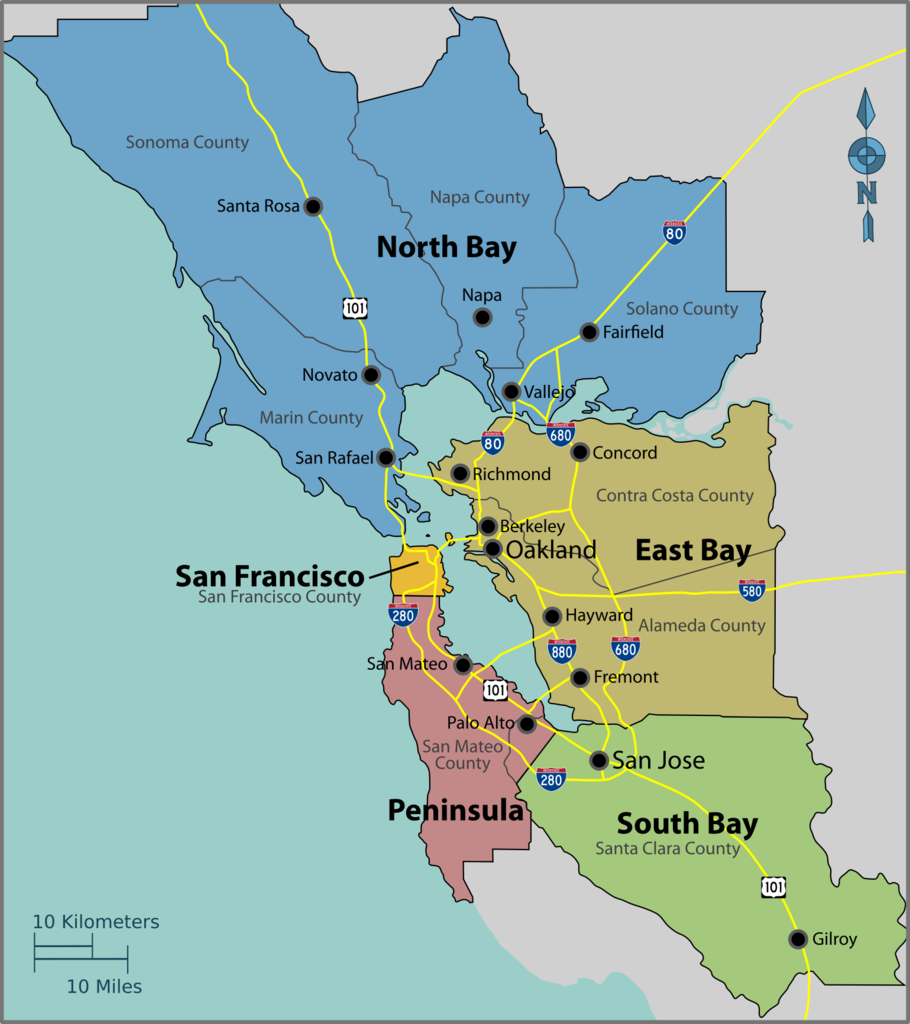
English: Map of the San Francisco Bay Area — the region in Northern California.
|
| 日期 | |
| 來源 | Image:Bayarea map.svg |
| 作者 | PerryPlanet |

|
File:Bayarea map.svg是本檔案的向量版本。 如果品質不低,就應該優先使用該檔案,而非PNG檔案。
File:Bayarea map.png → File:Bayarea map.svg
更多資訊請參閱Help:SVG/zh。 |
 |
授權條款
| 此作品已由其作者,User: (WT-shared) PerryPlanet at wts 維基導遊,釋出至公有領域。此授權條款在全世界均適用。 這可能在某些國家不合法,如果是的話: User: (WT-shared) PerryPlanet at wts 維基導遊授予任何人有權利使用此作品於任何用途,除受法律約束外,不受任何限制。
|
原始上傳日誌
| This file was imported from Wikivoyage WTS. |
The original description page was here. All following user names refer to wts.wikivoyage-old.
- 2010-10-17 03:39 (WT-shared) PerryPlanet[失效連結] 1438×1616 (481629 bytes) {{Imagecredit|credit=PerryPlanet|captureDate=10/16/2010|location=Bay Area (California)|source=[[Image:Bayarea map.svg]]|caption=Bay Area Reg (Import from wikitravel.org/shared)
檔案歷史
點選日期/時間以檢視該時間的檔案版本。
| 日期/時間 | 縮圖 | 尺寸 | 使用者 | 備註 | |
|---|---|---|---|---|---|
| 目前 | 2017年9月27日 (三) 11:51 | | 1,539 × 1,732(475 KB) | Haha169 | okay finally fixed |
| 2017年9月27日 (三) 11:50 |  | 1,539 × 1,734(475 KB) | Haha169 | fix minor inconsistency | |
| 2017年9月27日 (三) 11:48 |  | 1,539 × 1,732(473 KB) | Haha169 | change font for readability, adjust hierarchy in favor of the subregions (that's what this map is being used for), and remove airports due to clutter | |
| 2017年9月21日 (四) 04:51 |  | 1,462 × 1,645(500 KB) | Haha169 | ok was being lazy. fix sonoma county borders | |
| 2017年9月21日 (四) 03:40 |  | 1,451 × 1,634(494 KB) | Haha169 | Add santa clara county lines and restore Sonoma County, can't find any literature on what part of Sonoma county is cut off from the Bay Area | |
| 2012年11月17日 (六) 20:49 |  | 1,438 × 1,616(470 KB) | MGA73bot2 | {{BotMoveToCommons|wts.oldwikivoyage|year={{subst:CURRENTYEAR}}|month={{subst:CURRENTMONTHNAME}}|day={{subst:CURRENTDAY}}}} == {{int:filedesc}} == {{Information |description=Bay Area Regions Map. , Bay Area (California) * Map of: Bay Area (California)... |
檔案用途
下列3個頁面有用到此檔案:
全域檔案使用狀況
以下其他 wiki 使用了這個檔案:
- cy.wikipedia.org 的使用狀況
- de.wikivoyage.org 的使用狀況
- he.wikivoyage.org 的使用狀況
- it.wikivoyage.org 的使用狀況
- mr.wikipedia.org 的使用狀況