File:Collin County Texas Incorporated Areas Plano highlighted.svg

此 SVG 檔案的 PNG 預覽的大小:800 × 364 像素。 其他解析度:320 × 145 像素 | 640 × 291 像素 | 1,024 × 465 像素 | 1,280 × 582 像素 | 2,560 × 1,164 像素 | 1,100 × 500 像素。
原始檔案 (SVG 檔案,表面大小:1,100 × 500 像素,檔案大小:292 KB)
摘要
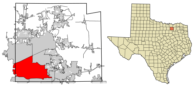
| 描述 | This map shows the incorporated areas in Collin County, Texas. Plano is highlighted in red. I created it in Inkscape using data from the Collin County GIS Website ([1]) and the North Central Texas Council of Governments Website ([2]). |
| 日期 | |
| 來源 | My own work, based on government information. Though I strove to be as accurate in the detail as possible, the information isn't one hundred percent accurate. |
| 作者 | Ixnayonthetimmay |
| 授權許可 (重用此檔案) |
Public Domain |
| 其他版本 | See Category:Maps of Collin County, Texas for other versions of this image. |
授權條款
| 我,此作品的版權所有人,釋出此作品至公共領域。此授權條款在全世界均適用。 這可能在某些國家不合法,如果是的話: 我授予任何人有權利使用此作品於任何用途,除受法律約束外,不受任何限制。 |
檔案歷史
點選日期/時間以檢視該時間的檔案版本。
| 日期/時間 | 縮圖 | 尺寸 | 使用者 | 備註 | |
|---|---|---|---|---|---|
| 目前 | 2008年2月14日 (四) 00:45 | | 1,100 × 500(292 KB) | Ixnayonthetimmay | == Summary == {{Information |Description=This map shows the incorporated areas in Collin County, Texas. Plano is highlighted in red. I created it in [[:en:Inkscape|Inksca |
檔案用途
下列頁面有用到此檔案:
全域檔案使用狀況
以下其他 wiki 使用了這個檔案:
- ang.wikipedia.org 的使用狀況
- ar.wikipedia.org 的使用狀況
- arz.wikipedia.org 的使用狀況
- ast.wikipedia.org 的使用狀況
- br.wikipedia.org 的使用狀況
- ca.wikipedia.org 的使用狀況
- ceb.wikipedia.org 的使用狀況
- cs.wikipedia.org 的使用狀況
- de.wikipedia.org 的使用狀況
- el.wikipedia.org 的使用狀況
- en.wikipedia.org 的使用狀況
- eo.wikipedia.org 的使用狀況
- et.wikipedia.org 的使用狀況
- eu.wikipedia.org 的使用狀況
- fa.wikipedia.org 的使用狀況
- fi.wikipedia.org 的使用狀況
- fr.wikipedia.org 的使用狀況
- fy.wikipedia.org 的使用狀況
- ga.wikipedia.org 的使用狀況
- hr.wikipedia.org 的使用狀況
- ht.wikipedia.org 的使用狀況
- hu.wikipedia.org 的使用狀況
- id.wikipedia.org 的使用狀況
- io.wikipedia.org 的使用狀況
- it.wikipedia.org 的使用狀況
- ja.wikipedia.org 的使用狀況
- ko.wikipedia.org 的使用狀況
- kw.wikipedia.org 的使用狀況
- mdf.wikipedia.org 的使用狀況
- ml.wikipedia.org 的使用狀況
- nl.wikipedia.org 的使用狀況
- pl.wikivoyage.org 的使用狀況
- pnb.wikipedia.org 的使用狀況
- ro.wikipedia.org 的使用狀況
- sco.wikipedia.org 的使用狀況
- sh.wikipedia.org 的使用狀況
- sk.wikipedia.org 的使用狀況
- sr.wikipedia.org 的使用狀況
- sv.wikipedia.org 的使用狀況
- ta.wikipedia.org 的使用狀況
- tr.wikipedia.org 的使用狀況
- tt.wikipedia.org 的使用狀況
- ur.wikipedia.org 的使用狀況
- vi.wikipedia.org 的使用狀況
- vo.wikipedia.org 的使用狀況
- www.wikidata.org 的使用狀況