File:Croatian Prevlaka in occupation by Montenegro and Serbia.jpg
此為最大尺寸。
Croatian_Prevlaka_in_occupation_by_Montenegro_and_Serbia.jpg (760 × 560 像素,檔案大小:118 KB,MIME 類型:image/jpeg)
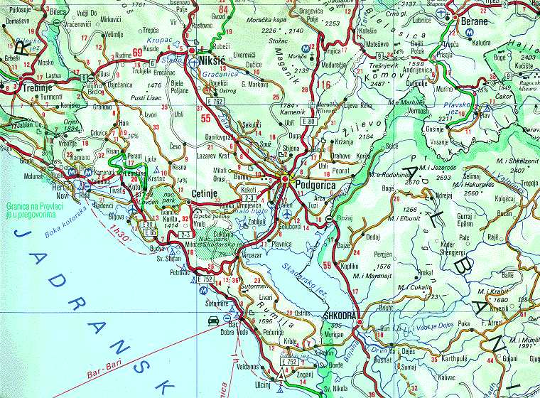
| 描述 | Map of Montenegrin Littoral Region and Boka kotorska in the time of occupation of Croatian Prevlaka Region which is the remaining part of Boka kotorska that belongs to Croatia. | |||
| 日期 | 1991-2002 (occupation ended 1992-10-20 at 20:30) (UNMIK mission ended 2002-12-20). | |||
| 來源 | Ministry of Foreign Affairs of the State Union Serbia and Montenegro (before that MFA of Federal Republic of Yugoslavia | |||
| 作者 | Serbian Official Cartography (Public Service at the time). | |||
| 授權許可 (重用此檔案) |
|
|||
| 其他版本 | Geographical version. |

檔案歷史
點選日期/時間以檢視該時間的檔案版本。
| 日期/時間 | 縮圖 | 尺寸 | 使用者 | 備註 | |
|---|---|---|---|---|---|
| 目前 | 2008年2月16日 (六) 02:05 | | 760 × 560(118 KB) | Imbris~commonswiki | {{Information |Description=Map of Montenegrin ''Littoral Region'' and ''Boka kotorska'' in the time of occupation of Croatian hr:Prevlaka Region which is the remaining part of Boka kotorska that belongs to Croatia. |Source=[http://www.mfa.gov.yu/Fact |
檔案用途
下列頁面有用到此檔案:
全域檔案使用狀況
以下其他 wiki 使用了這個檔案:
- ca.wikipedia.org 的使用狀況
- ckb.wikipedia.org 的使用狀況
- de.wikipedia.org 的使用狀況
- en.wikipedia.org 的使用狀況
- fa.wikipedia.org 的使用狀況
- hr.wikipedia.org 的使用狀況
- id.wikipedia.org 的使用狀況
- mzn.wikipedia.org 的使用狀況
- nl.wikipedia.org 的使用狀況
- ru.wikipedia.org 的使用狀況
- sh.wikipedia.org 的使用狀況
- sq.wikipedia.org 的使用狀況
- www.wikidata.org 的使用狀況