File:Cumberland Basin looking North.jpg

預覽大小:800 × 533 像素。 其他解析度:320 × 213 像素 | 640 × 427 像素 | 1,024 × 683 像素 | 1,280 × 853 像素 | 2,560 × 1,707 像素 | 4,896 × 3,264 像素。
原始檔案 (4,896 × 3,264 像素,檔案大小:9.83 MB,MIME 類型:image/jpeg)
摘要
| 描述 |
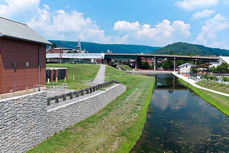
English: This is the basin at the end of the Chesapeake and Ohio Canal, looking north toward the end of the canal. Guard lock #8 is at the end of the channel on the left. Interstate Highway 68 / US 40 / US 220 runs on that bridge in the background. The Western Maryland Station is just visiable (brick building) beyond the highway bridge. Shops at Canal Place are to the right of the basin. Potomac River is to the left, just beyond the flood wall. |
| 來源 | 自己的作品 |
| 作者 | Bonnachoven |
授權條款
我,本作品的著作權持有者,決定用以下授權條款發佈本作品:
| 此檔案在創用CC CC0 1.0 通用公有領域貢獻宣告之下分發。 | |
| 在此宣告之下分發本作品者,已依據各國著作權法,在全世界放棄其對本作品所擁有的著作權及所有相關相似的法律權利,從而將本作品貢獻至公有領域。您可以複製、修改、分發和演示該作品,用於任何商業用途,所有這些都不需要請求授權。
|
檔案歷史
點選日期/時間以檢視該時間的檔案版本。
| 日期/時間 | 縮圖 | 尺寸 | 使用者 | 備註 | |
|---|---|---|---|---|---|
| 目前 | 2013年7月20日 (六) 10:01 | | 4,896 × 3,264(9.83 MB) | Bonnachoven | {{Information |Description ={{en|1=This is the basin at the end of the Chesapeake and Ohio Canal, looking north toward the end of the canal. Guard lock #8 is at the end of the channel on the left. Interstate Highway 68 / US 40 / US 220 runs on that ... |
檔案用途
下列頁面有用到此檔案:
全域檔案使用狀況
以下其他 wiki 使用了這個檔案:
- ceb.wikipedia.org 的使用狀況
- en.wikipedia.org 的使用狀況
- en.wikivoyage.org 的使用狀況
- he.wikivoyage.org 的使用狀況
- ja.wikipedia.org 的使用狀況
- pl.wikipedia.org 的使用狀況
- pnb.wikipedia.org 的使用狀況
- sv.wikipedia.org 的使用狀況
- ur.wikipedia.org 的使用狀況
- www.wikidata.org 的使用狀況