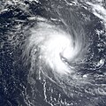
File:Gafilo 2004-03-03.jpg

預覽大小:600 × 600 像素。 其他解析度:240 × 240 像素 | 480 × 480 像素 | 768 × 768 像素 | 1,024 × 1,024 像素 | 2,048 × 2,048 像素 | 6,000 × 6,000 像素。
原始檔案 (6,000 × 6,000 像素,檔案大小:3.88 MB,MIME 類型:image/jpeg)
檔案歷史
點選日期/時間以檢視該時間的檔案版本。
| 日期/時間 | 縮圖 | 尺寸 | 使用者 | 備註 | |
|---|---|---|---|---|---|
| 目前 | 2013年4月27日 (六) 12:10 |  | 6,000 × 6,000(3.88 MB) | Meow | Official size |
| 2006年11月16日 (四) 20:54 |  | 6,000 × 6,000(4.68 MB) | Good kitty | == Summary == {{Information |Description=The MODIS instrument onboard NASA's Terra satellite captured this true-color image of Tropical Cyclone Gafilo as it was churning in the Indian Ocean approximately 800 miles northwest of northern Madagascar. At the |
檔案用途
下列頁面有用到此檔案:
全域檔案使用狀況
以下其他 wiki 使用了這個檔案:
- en.wikipedia.org 的使用狀況
- fr.wikipedia.org 的使用狀況
- uk.wikipedia.org 的使用狀況


