File:Irma 2017-09-05 1706Z.jpg
預覽大小:450 × 600 像素。 其他解析度:180 × 240 像素 | 360 × 480 像素 | 576 × 768 像素 | 768 × 1,024 像素 | 1,536 × 2,048 像素 | 4,950 × 6,600 像素。
原始檔案 (4,950 × 6,600 像素,檔案大小:8.39 MB,MIME 類型:image/jpeg)
摘要
| 描述 |
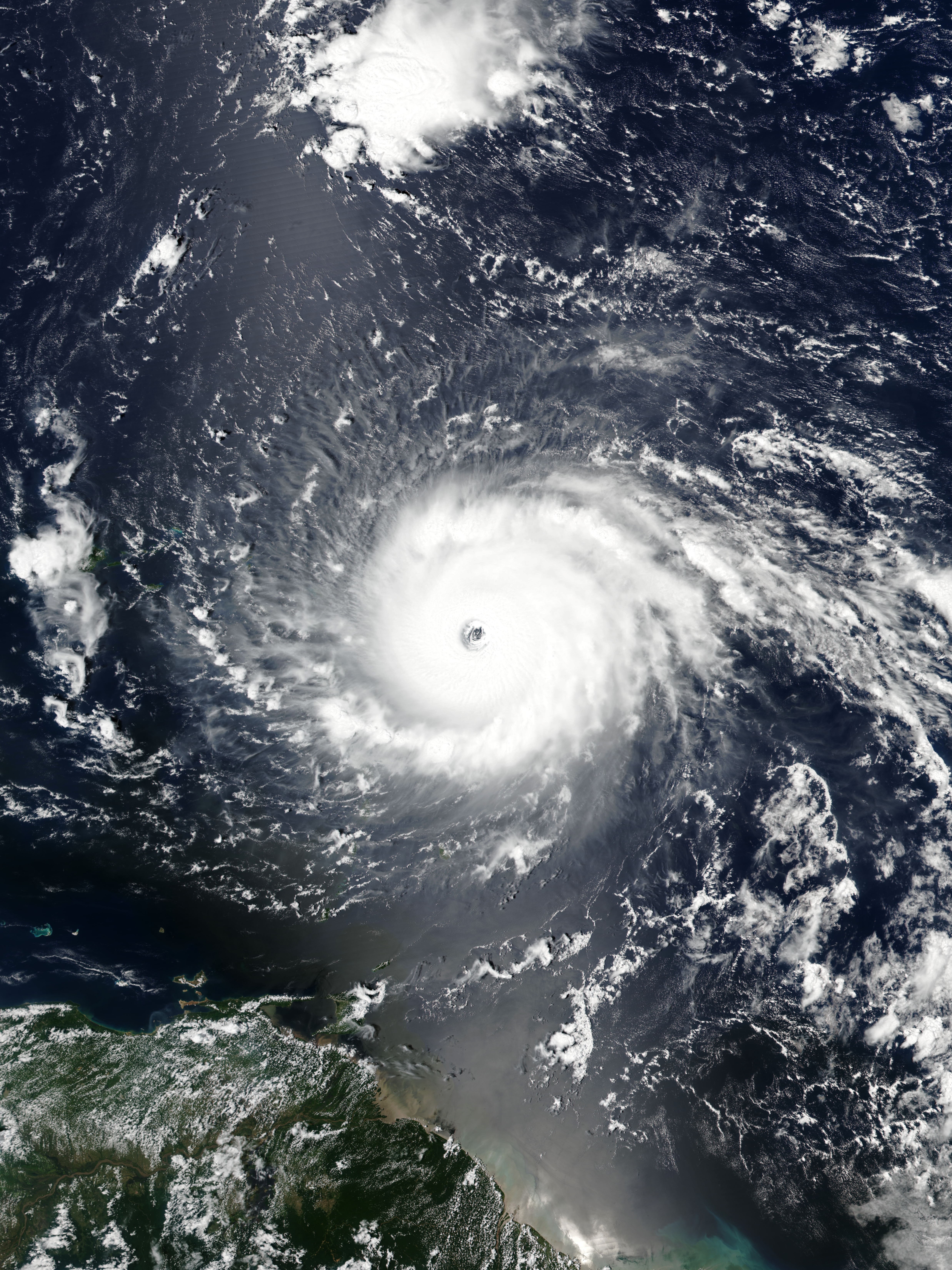
English: Hurricane Irma approaching the Leeward Islands at peak intensity on September 5, 2017 as the third most intense Atlantic hurricane on record in terms of sustained winds. |
| 日期 | |
| 來源 | EOSDIS Worldview |
| 作者 | VIIRS image captured by NOAA’s Suomi NPP satellite |
| 拍攝地點 | | 位於此地的本圖片與其他圖片: OpenStreetMap |
|---|
授權條款
| 本作品由NASA創作,屬於公有領域。根據NASA的版權政策:“NASA的創作除非另有聲明否則不受版權保護。”(參見:Template:PD-USGov/zh,NASA版權政策或JPL圖像使用政策) | ||
 |
警告:
|
檔案歷史
點選日期/時間以檢視該時間的檔案版本。
| 日期/時間 | 縮圖 | 尺寸 | 使用者 | 備註 | |
|---|---|---|---|---|---|
| 目前 | 2021年5月15日 (六) 01:21 | | 4,950 × 6,600(8.39 MB) | Supportstorm | Reverted to version as of 21:19, 5 September 2017 (UTC) |
| 2021年5月15日 (六) 00:12 |  | 437 × 452(89 KB) | Super Cyclonic Storm Corona | Crop a bit. | |
| 2017年9月5日 (二) 21:19 |  | 4,950 × 6,600(8.39 MB) | Meow | User created page with UploadWizard |
檔案用途
下列2個頁面有用到此檔案:
全域檔案使用狀況
以下其他 wiki 使用了這個檔案:
- cs.wikipedia.org 的使用狀況
- en.wikipedia.org 的使用狀況
- Portal:Tropical cyclones/Anniversaries/September
- Portal:Tropical cyclones/Anniversaries/September/5
- User:LightandDark2000/My Notable Storms
- Talk:Hurricane Irma/Archive 2
- User:Tfmbty/List of the most intense tropical cyclones since 1979
- User talk:36.82.216.113
- Talk:2018 Atlantic hurricane season/Archive 2
- User talk:82.8.147.67
- es.wikipedia.org 的使用狀況
- et.wikipedia.org 的使用狀況
- hu.wikipedia.org 的使用狀況
- pt.wikipedia.org 的使用狀況
- ru.wikipedia.org 的使用狀況
- sd.wikipedia.org 的使用狀況
- sr.wikipedia.org 的使用狀況
- th.wikipedia.org 的使用狀況
- uk.wikipedia.org 的使用狀況
- uz.wikipedia.org 的使用狀況