File:Madeline 1976 rainfall.gif

預覽大小:590 × 599 像素。 其他解析度:236 × 240 像素 | 472 × 480 像素 | 870 × 884 像素。
原始檔案 (870 × 884 像素,檔案大小:31 KB,MIME 類型:image/gif)
摘要
| 描述 |
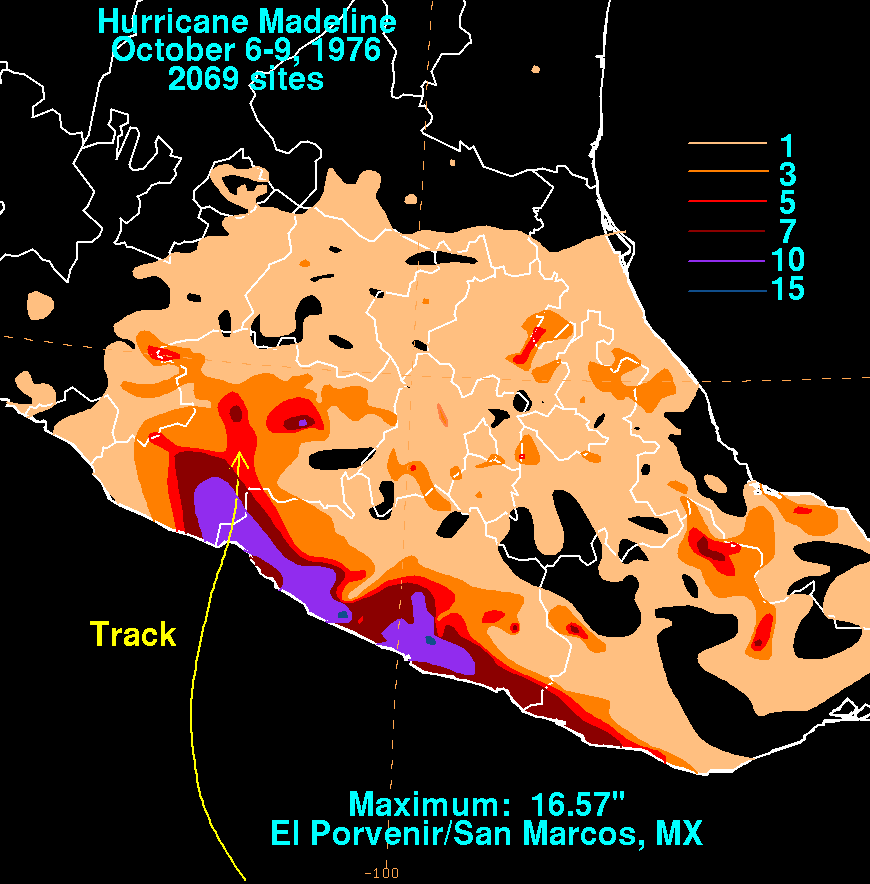
English: Storm total rainfall map of Hurricane Madeline during October 1976. |
|||
| 日期 | ||||
| 來源 | WPC tropical cyclone rainfall data | |||
| 作者 | David Roth, Weather Prediction Center, Camp Springs, Maryland | |||
| 授權許可 (重用此檔案) |
|
檔案歷史
點選日期/時間以檢視該時間的檔案版本。
| 日期/時間 | 縮圖 | 尺寸 | 使用者 | 備註 | |
|---|---|---|---|---|---|
| 目前 | 2010年4月3日 (六) 17:37 | | 870 × 884(31 KB) | Cyclonebiskit | {{Information |Description={{en|1=A tropical disturbance formed 300 miles south of the coast of Guatemala, quickly gaining tropical storm strength on September 28th. The system weakened thereafter, becoming ill-defined on the 30th. It remnant tropical d |
檔案用途
下列頁面有用到此檔案:
全域檔案使用狀況
以下其他 wiki 使用了這個檔案:
- en.wikipedia.org 的使用狀況