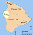
File:Mapmaunaloa.svg

此 SVG 檔案的 PNG 預覽的大小:279 × 299 像素。 其他解析度:224 × 240 像素 | 448 × 480 像素 | 717 × 768 像素 | 955 × 1,024 像素 | 1,911 × 2,048 像素。
原始檔案 (SVG 檔案,表面大小:279 × 299 像素,檔案大小:94 KB)
檔案歷史
點選日期/時間以檢視該時間的檔案版本。
| 日期/時間 | 縮圖 | 尺寸 | 使用者 | 備註 | |
|---|---|---|---|---|---|
| 目前 | 2010年7月10日 (六) 17:03 |  | 279 × 299(94 KB) | Malus Catulus | Latest version |
| 2010年7月10日 (六) 15:16 |  | 279 × 299(94 KB) | Malus Catulus | Converted last text | |
| 2010年7月10日 (六) 15:07 |  | 279 × 299(75 KB) | Malus Catulus | Had to convert text to path | |
| 2010年7月10日 (六) 15:05 |  | 279 × 299(26 KB) | Malus Catulus | {{Information |Description={{en|Map showing relationship of Mauna Loa to other volcanoes that form the Big Island of Hawaii}} |Source=*File:Mapmaunaloa.png |Date=2010-07-10 15:03 (UTC) |Author=*[[:File:Mapmaunaloa.pn |
檔案用途
下列頁面有用到此檔案:
全域檔案使用狀況
以下其他 wiki 使用了這個檔案:
- af.wikipedia.org 的使用狀況
- ar.wikipedia.org 的使用狀況
- ast.wikipedia.org 的使用狀況
- ca.wikipedia.org 的使用狀況
- da.wikipedia.org 的使用狀況
- de.wikipedia.org 的使用狀況
- el.wikipedia.org 的使用狀況
- en.wikipedia.org 的使用狀況
- es.wikipedia.org 的使用狀況
- he.wikipedia.org 的使用狀況
- hr.wikipedia.org 的使用狀況
- hu.wikipedia.org 的使用狀況
- hu.wiktionary.org 的使用狀況
- id.wikipedia.org 的使用狀況
- is.wikipedia.org 的使用狀況
- it.wikipedia.org 的使用狀況
- ja.wikipedia.org 的使用狀況
- la.wikipedia.org 的使用狀況
- mk.wikipedia.org 的使用狀況
- ml.wikipedia.org 的使用狀況
- no.wikipedia.org 的使用狀況
- ro.wikipedia.org 的使用狀況
- sh.wikipedia.org 的使用狀況
- sr.wikipedia.org 的使用狀況
- th.wikipedia.org 的使用狀況
- tr.wikipedia.org 的使用狀況


