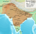
File:Maurya Empire, c.250 BCE 2.png

預覽大小:642 × 600 像素。 其他解析度:257 × 240 像素 | 514 × 480 像素 | 822 × 768 像素 | 1,200 × 1,121 像素。
原始檔案 (1,200 × 1,121 像素,檔案大小:2.26 MB,MIME 類型:image/png)
檔案歷史
點選日期/時間以檢視該時間的檔案版本。
| 日期/時間 | 縮圖 | 尺寸 | 使用者 | 備註 | |
|---|---|---|---|---|---|
| 目前 | 2024年4月30日 (二) 11:01 |  | 1,200 × 1,121(2.26 MB) | Avantiputra7 | western borders: see talk page |
| 2024年4月16日 (二) 04:37 |  | 1,200 × 1,121(2.26 MB) | Avantiputra7 | Reverted to version as of 11:12, 5 April 2024 (UTC) - vandalism | |
| 2024年4月14日 (日) 07:37 |  | 1,200 × 1,121(2.18 MB) | Layman7676 | Reverted to version as of 11:12, 4 April 2024 (UTC) The map you are publishing isn't based on wha vincient Arthur really said. | |
| 2024年4月5日 (五) 11:12 |  | 1,200 × 1,121(2.26 MB) | Avantiputra7 | Reverted to version as of 08:27, 3 April 2024 (UTC) - vandalism | |
| 2024年4月4日 (四) 11:12 |  | 1,200 × 1,121(2.18 MB) | Chakravartin1929 | Reverted to version as of 05:41, 26 March 2024 (UTC) This is the true map. It depicts The mauryan map accurately. | |
| 2024年4月3日 (三) 08:27 |  | 1,200 × 1,121(2.26 MB) | Avantiputra7 | Reverted to version as of 11:06, 3 March 2024 (UTC) | |
| 2024年3月26日 (二) 05:41 |  | 1,200 × 1,121(2.18 MB) | Chakravartin1929 | Reverted to version as of 09:06, 3 March 2024 (UTC) | |
| 2024年3月3日 (日) 11:06 |  | 1,200 × 1,121(2.26 MB) | Avantiputra7 | Reverted to version as of 11:10, 29 January 2024 (UTC) | |
| 2024年3月3日 (日) 09:06 |  | 1,200 × 1,121(2.18 MB) | Chakravartin1929 | Reverted to version as of 16:50, 14 December 2023 (UTC) This map is better. | |
| 2024年1月29日 (一) 11:10 |  | 1,200 × 1,121(2.26 MB) | Avantiputra7 | tweaked |
檔案用途
下列頁面有用到此檔案:
全域檔案使用狀況
以下其他 wiki 使用了這個檔案:
- am.wikipedia.org 的使用狀況
- ar.wikipedia.org 的使用狀況
- azb.wikipedia.org 的使用狀況
- ba.wikipedia.org 的使用狀況
- be.wikipedia.org 的使用狀況
- bg.wikipedia.org 的使用狀況
- bn.wikipedia.org 的使用狀況
- ckb.wikipedia.org 的使用狀況
- de.wikipedia.org 的使用狀況
- en.wikipedia.org 的使用狀況
- Ashoka
- Talk:History of India
- Magadha
- Maurya Empire
- Kalinga (historical region)
- Economic history of India
- Tamilakam
- Pataliputra
- Indian people
- Three Crowned Kings
- List of rulers of Odisha
- Talk:India/Archive 39
- Talk:Maurya Empire/Archive 1
- Wikipedia:Dispute resolution noticeboard/Archive 135
- Talk:Maurya Empire/Archive 2
- List of Maurya Emperors
- User:Falcaorib/Ancient Empires (300 BC-01 AD)
- en.wiktionary.org 的使用狀況
- es.wikipedia.org 的使用狀況
- he.wikipedia.org 的使用狀況
- hy.wikipedia.org 的使用狀況
- id.wikipedia.org 的使用狀況
- it.wikipedia.org 的使用狀況
- ja.wikipedia.org 的使用狀況
- kn.wikipedia.org 的使用狀況
- ko.wikipedia.org 的使用狀況
- ml.wikipedia.org 的使用狀況
- mzn.wikipedia.org 的使用狀況
- nl.wikipedia.org 的使用狀況
- pnb.wikipedia.org 的使用狀況
檢視此檔案的更多全域使用狀況。

