File:Netherlands, Winschoten, map, around 1865-1870.jpg

預覽大小:698 × 600 像素。 其他解析度:279 × 240 像素 | 558 × 480 像素 | 894 × 768 像素 | 1,191 × 1,024 像素 | 1,396 × 1,200 像素。
原始檔案 (1,396 × 1,200 像素,檔案大小:648 KB,MIME 類型:image/jpeg)
摘要
| 描述 |
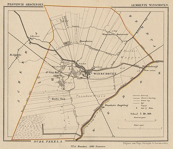
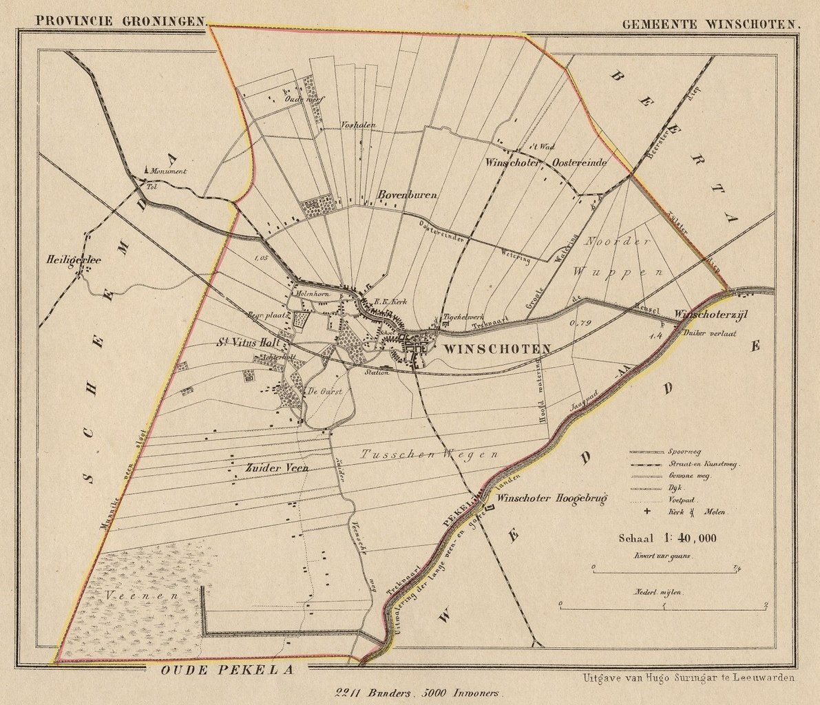
Nederlands: Kaart uit de periode 1865-1870 van de gemeente Winschoten (Prov. Groningen).
English: Map from around 1865-1870 of the municipality of Winschoten (Province of Groningen, Netherlands). |
| 日期 | Published around 1870 as part of a series of provincial atlases of the Netherlands. |
| 來源 | Gemeente-atlas van Nederland naar officieele bronnen bewerkt. |
| 作者 | J. Kuyper |
| 授權許可 (重用此檔案) |
This image is in the public domain. The author J. Kuyper died in 1908. [In the Netherlands copyright expires 70 years after the death of the author or 70 years after first publication in the case of anonymous or pseudonymous works or works published by a legal entity]. [Het auteursrecht in Nederland vervalt 70 jaar na de dood van de auteur of 70 jaar na de eerste openbaarmaking van het werk, indien het gaat om een anoniem of om een onder pseudoniem verschenen werk of werk van een rechtspersoon]. |
授權條款
|
本作品在其來源國以及其他著作權期限是作者逝世後70年或以下的國家與地區屬於公有領域。
| |
| 此作品無已知的著作權限制,亦不受所有相關和鄰接的權利限制。 | |
The old town hall of Winschoten is at:
| 拍攝地點 | | 位於此地的本圖片與其他圖片: OpenStreetMap |
|---|
檔案歷史
點選日期/時間以檢視該時間的檔案版本。
| 日期/時間 | 縮圖 | 尺寸 | 使用者 | 備註 | |
|---|---|---|---|---|---|
| 目前 | 2011年11月25日 (五) 10:02 | | 1,396 × 1,200(648 KB) | Loranchet | {{Information |Description ={{nl|1=Kaart uit de periode 1865-1870 van de gemeente Winschoten (Prov. Groningen).}} {{en|1=Map from around 1865-1870 of the municipality of Winschoten (Province of Groningen, Netherlands).}} |Source =Gemeente-atlas |
檔案用途
下列頁面有用到此檔案:
全域檔案使用狀況
以下其他 wiki 使用了這個檔案:
- en.wikipedia.org 的使用狀況
- fy.wikipedia.org 的使用狀況
- nl.wikipedia.org 的使用狀況
- www.wikidata.org 的使用狀況