File:Norisring track map.svg

此 SVG 檔案的 PNG 預覽的大小:800 × 552 像素。 其他解析度:320 × 221 像素 | 640 × 442 像素 | 1,024 × 707 像素 | 1,280 × 883 像素 | 2,560 × 1,767 像素 | 1,423 × 982 像素。
原始檔案 (SVG 檔案,表面大小:1,423 × 982 像素,檔案大小:139 KB)
摘要
| 描述 |
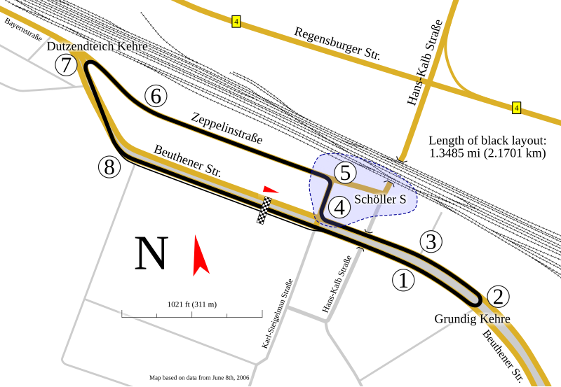
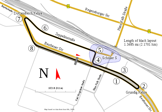
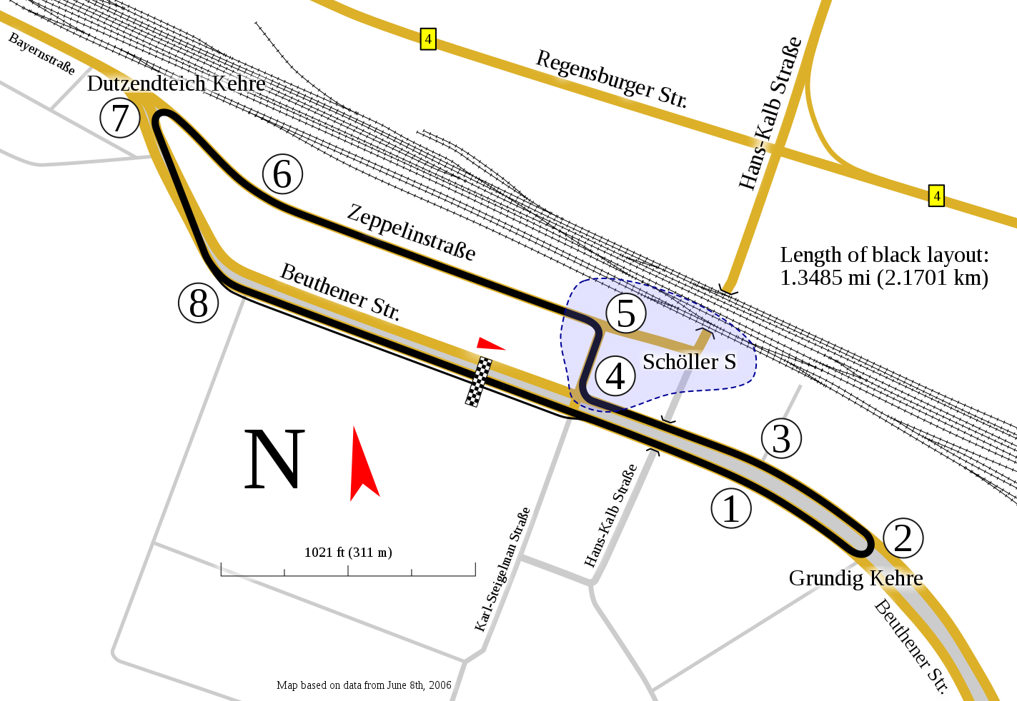
English: Track map for use with Norisring |
| 日期 | |
| 來源 | 自己的作品 |
| 作者 | Will Pittenger |
| 其他版本 |
|


本vector image使用Inkscape創作 .
| 拍攝地點 | | 位於此地的本圖片與其他圖片: OpenStreetMap |
|---|
授權條款
我,本作品的著作權持有者,決定用以下授權條款發佈本作品:
此檔案採用創用CC 姓名標示-相同方式分享 3.0 未在地化版本授權條款。
- 您可以自由:
- 分享 – 複製、發佈和傳播本作品
- 重新修改 – 創作演繹作品
- 惟需遵照下列條件:
- 姓名標示 – 您必須指名出正確的製作者,和提供授權條款的連結,以及表示是否有對內容上做出變更。您可以用任何合理的方式來行動,但不得以任何方式表明授權條款是對您許可或是由您所使用。
- 相同方式分享 – 如果您利用本素材進行再混合、轉換或創作,您必須基於如同原先的相同或兼容的條款,來分布您的貢獻成品。
檔案歷史
點選日期/時間以檢視該時間的檔案版本。
| 日期/時間 | 縮圖 | 尺寸 | 使用者 | 備註 | |
|---|---|---|---|---|---|
| 目前 | 2010年2月5日 (五) 06:48 | | 1,423 × 982(139 KB) | Will Pittenger | Corrections on the number of turns and the location of pit lane. Also found the missing items from the first version (they were out of frame). |
| 2010年1月29日 (五) 12:52 |  | 1,423 × 982(147 KB) | Will Pittenger | Some elements like scale were missing. This version adds them. | |
| 2010年1月29日 (五) 09:58 |  | 1,423 × 982(142 KB) | Will Pittenger | {{Information |Description={{en|1=Track map for use with w:Norisring}} |Source={{own}} |Author=Will Pittenger |Date=2009-01-29 |Permission= |other_versions=<gallery>File:Norisring map.gif|Norisring map.gif—Older GIF with |
檔案用途
下列頁面有用到此檔案:
全域檔案使用狀況
以下其他 wiki 使用了這個檔案:
- de.wikipedia.org 的使用狀況
- en.wikipedia.org 的使用狀況
- es.wikipedia.org 的使用狀況
- fi.wikipedia.org 的使用狀況
- fr.wikipedia.org 的使用狀況
- gl.wikipedia.org 的使用狀況
- hu.wikipedia.org 的使用狀況
- id.wikipedia.org 的使用狀況
- it.wikipedia.org 的使用狀況
- ja.wikipedia.org 的使用狀況
- ms.wikipedia.org 的使用狀況
- nl.wikipedia.org 的使用狀況
- no.wikipedia.org 的使用狀況
- pl.wikipedia.org 的使用狀況
- pt.wikipedia.org 的使用狀況
- ru.wikipedia.org 的使用狀況
- sv.wikipedia.org 的使用狀況
- www.wikidata.org 的使用狀況