File:Poland powiaty.png
預覽大小:800 × 548 像素。 其他解析度:320 × 219 像素 | 640 × 439 像素 | 1,024 × 702 像素 | 1,281 × 878 像素。
原始檔案 (1,281 × 878 像素,檔案大小:58 KB,MIME 類型:image/png)
摘要
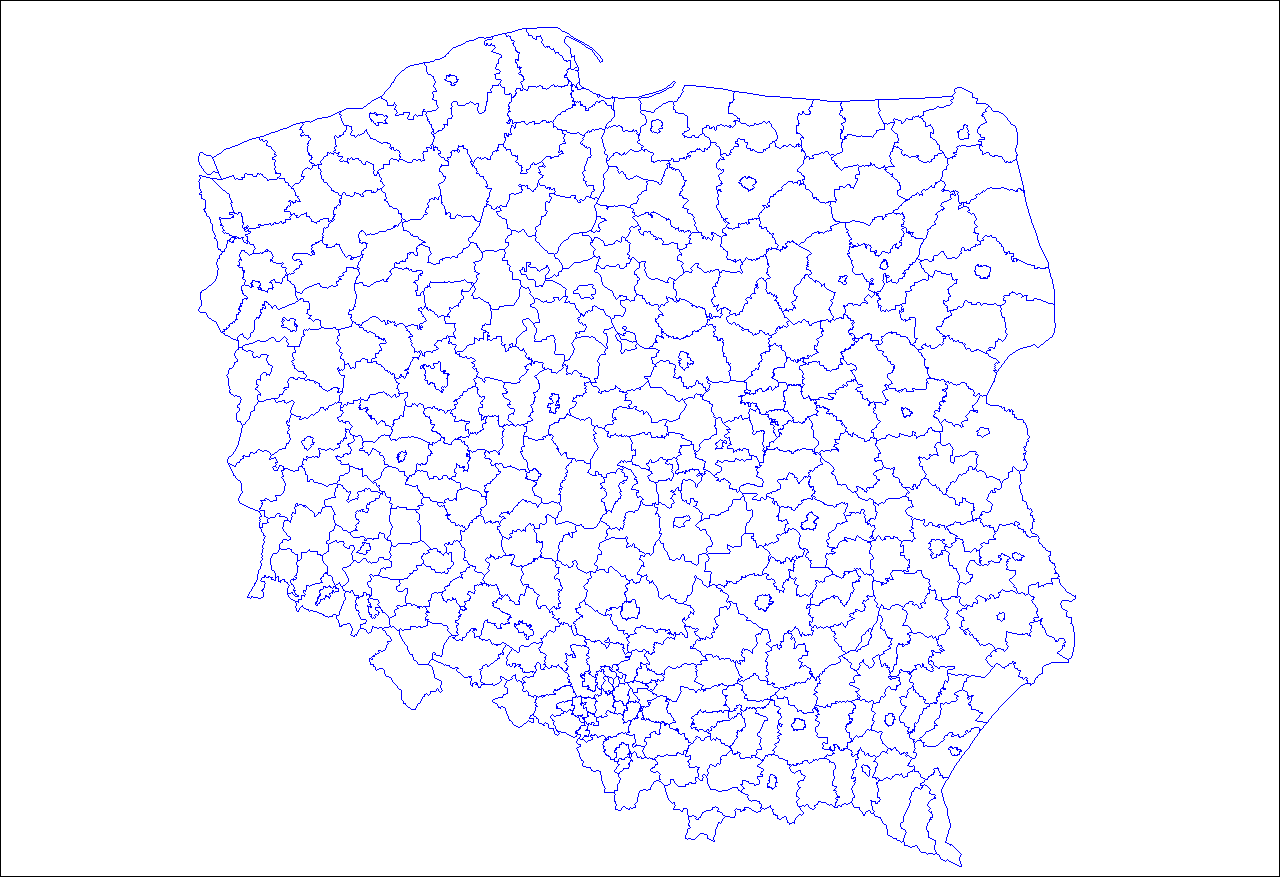
| 描述 | Map of the powiaty (counties) of Poland. Created by Rarelibra 03:07, 30 December 2006 (UTC) for public domain use, using MapInfo Professional v8.5 and various mapping resources. |
| 日期 | 2006年12月30日 (原始上傳日期) |
| 來源 | 无法识别来源。根据版权声明推断为其自己的作品。 |
| 作者 | 无法识别作者。根据版权声明推断作者为Rarelibra。 |
授權條款
| 我,此作品的版權所有人,釋出此作品至公共領域。此授權條款在全世界均適用。 這可能在某些國家不合法,如果是的話: 我授予任何人有權利使用此作品於任何用途,除受法律約束外,不受任何限制。 |
derivative works
Derivative works of this file: Single seat constituencies - elections to the Senate of Poland.png
檔案歷史
點選日期/時間以檢視該時間的檔案版本。
| 日期/時間 | 縮圖 | 尺寸 | 使用者 | 備註 | |
|---|---|---|---|---|---|
| 目前 | 2007年3月16日 (五) 14:28 | | 1,281 × 878(58 KB) | Rarelibra | Upload new and updated/accurate version. |
| 2006年12月30日 (六) 03:07 |  | 1,253 × 868(41 KB) | Rarelibra | Map of the powiaty (counties) of Poland. Created by ~~~~ for public domain use, using MapInfo Professional v8.5 and various mapping resources. |
檔案用途
沒有使用此檔案的頁面。
全域檔案使用狀況
以下其他 wiki 使用了這個檔案:
- en.wikipedia.org 的使用狀況
- jv.wikipedia.org 的使用狀況