File:Roman Empire 600 AD.PNG
此為最大尺寸。
Roman_Empire_600_AD.PNG (694 × 396 像素,檔案大小:13 KB,MIME 類型:image/png)
摘要
| 描述 |
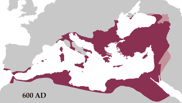
English: Map of the Roman Empire (purple) and its vassals (pink) in 600 AD during the reign of Emperor Maurice. The vassals are the Abasgians (top), the Kingdom of Iberia (northeast) and the Ghassanids (east) |
|||
| 日期 | ||||
| 來源 | 自己的作品 | |||
| 作者 | Tataryn77 | |||
| 其他版本 |
|


授權條款
| 我,此作品的版權所有人,釋出此作品至公共領域。此授權條款在全世界均適用。 這可能在某些國家不合法,如果是的話: 我授予任何人有權利使用此作品於任何用途,除受法律約束外,不受任何限制。 |
檔案歷史
點選日期/時間以檢視該時間的檔案版本。
| 日期/時間 | 縮圖 | 尺寸 | 使用者 | 備註 | |
|---|---|---|---|---|---|
| 目前 | 2012年8月10日 (五) 16:03 | | 694 × 396(13 KB) | DIREKTOR | Tyrian purple |
| 2012年3月20日 (二) 12:20 |  | 694 × 396(17 KB) | Tataryn | Added coastal corridor from Dalmatia to Italy. The Exarchate periodically held the corridor from the island of Grado. The fact that the exarch of Ravenna defeated an Avar attack on Istria during Maurice's reign suggests the Romans held the corridor dur... | |
| 2012年3月1日 (四) 23:35 |  | 694 × 396(19 KB) | Tataryn | Added Ghassanids as vassals. | |
| 2012年3月1日 (四) 23:30 |  | 694 × 396(19 KB) | Tataryn | Added Lazica, and Abasgians as vassals. | |
| 2012年3月1日 (四) 04:42 |  | 694 × 396(19 KB) | Tataryn | Fixed eastern border. | |
| 2012年2月29日 (三) 18:28 |  | 694 × 396(19 KB) | Tataryn | Fixed date. | |
| 2012年2月29日 (三) 13:37 |  | 694 × 396(19 KB) | Tataryn | Better Map. | |
| 2009年11月16日 (一) 18:36 |  | 720 × 516(65 KB) | Tataryn | {{Information |Description={{en|1=Map of the Roman Empire in 600 AD during the reign of Emperor Maurice.}} |Source={{own}} |Author=Tataryn77 |Date=November 16, 2009 |Permission= |other_versions= }} |
檔案用途
下列2個頁面有用到此檔案:
全域檔案使用狀況
以下其他 wiki 使用了這個檔案:
- ace.wikipedia.org 的使用狀況
- ar.wikipedia.org 的使用狀況
- azb.wikipedia.org 的使用狀況
- ba.wikipedia.org 的使用狀況
- bg.wikipedia.org 的使用狀況
- de.wikipedia.org 的使用狀況
- en.wikipedia.org 的使用狀況
- eo.wikipedia.org 的使用狀況
- es.wikipedia.org 的使用狀況
- et.wikipedia.org 的使用狀況
- fa.wikipedia.org 的使用狀況
- fr.wikipedia.org 的使用狀況
- Grèce
- Maurice (empereur)
- Justinien Ier
- Histoire de l'Empire byzantin
- Bataille du Yarmouk
- Wikipédia:Sélection/Monde byzantin
- Guerre perso-byzantine de 602-628
- Empire byzantin
- Histoire de la marine algérienne
- Diplomatie byzantine
- Wikipédia:Lumière sur/Février 2019
- Wikipédia:Lumière sur/Empire byzantin
- Wikipédia:Wikimag/2019/9
- Dynastie des Justiniens
- Wikipédia:Lumière sur/Février 2024
- Wikipédia:Wikimag/2024/10
- he.wikipedia.org 的使用狀況
- hr.wikipedia.org 的使用狀況
- hu.wikipedia.org 的使用狀況
- hy.wikipedia.org 的使用狀況
- hyw.wikipedia.org 的使用狀況
檢視此檔案的更多全域使用狀況。