File:RzeczpospolitaII.png
預覽大小:624 × 600 像素。 其他解析度:250 × 240 像素 | 499 × 480 像素 | 799 × 768 像素 | 1,112 × 1,069 像素。
原始檔案 (1,112 × 1,069 像素,檔案大小:186 KB,MIME 類型:image/png)
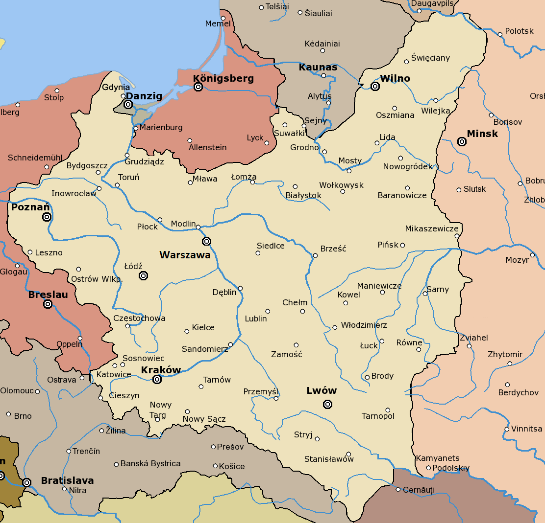
Second Polish Republic. Map based on File:Rzeczpospolita 1920.png.
This image is a derivative work of the following images:
- File:Rzeczpospolita_1920.png licensed with Cc-by-sa-3.0-migrated, GFDL
- 2009-12-05T08:35:28Z DJ Sturm 2000x1534 (369919 Bytes) Correct borders, improved Estonia
- 2009-08-16T14:37:51Z Halibutt 2000x1534 (349775 Bytes) Reverted to version as of 06:33, 8 May 2005 (don't do this. Modify the svg version instead, without those horrible colours and copy-paste leftovers)
- 2009-03-27T14:30:53Z DJ Sturm 2000x1534 (368552 Bytes) Fixed borders of Estonia, Latvia, Lithuania, Soviet Union and Germany, added some towns.
- 2005-05-08T06:33:43Z Halibutt 2000x1534 (349775 Bytes) Reverted to earlier revision
- 2005-05-07T21:41:55Z DeirYassin 2000x1534 (314976 Bytes) Corrected borders of Latvia and Russia, Estonia and Russia according to real interwar, rather than current, borders; the Lithuanian claim is shown.
- 2005-05-07T20:50:35Z DeirYassin 2000x1534 (314976 Bytes)
- 2005-05-07T20:47:17Z DeirYassin 2000x1534 (314976 Bytes)
- 2005-04-07T21:04:53Z Halibutt 2000x1534 (349775 Bytes) New additions: borders of Czechoslovakia corrected, new towns added, more changes to follow. Any suggestions?
- 2005-04-05T07:53:46Z Halibutt 2000x1534 (267139 Bytes) Newer version
- 2005-04-04T07:02:24Z Halibutt 2000x1534 (236688 Bytes) new version: Hungaro-Czechoslovak border corrected and town names added
- 2005-04-02T12:06:46Z Halibutt 2000x1534 (148548 Bytes) new version, colours added
- 2005-04-02T05:30:08Z Halibutt 2000x1534 (151894 Bytes) Early version of my map of Poland and Eastern Europe between 1918 and 1945. So far it features the borders and major towns and cities, as well as the frontlines of the [[Polish-Bolshevik War]]. The colours and fonts and other

|
已授權您依據自由軟體基金會發行的無固定段落、封面文字和封底文字GNU自由文件授權條款1.2版或任意後續版本,對本檔進行複製、傳播和/或修改。該協議的副本列在GNU自由文件授權條款中。 |
| 此檔案採用創用CC 姓名標示-相同方式分享 3.0 未在地化版本授權條款。 | ||
| ||
| 已新增授權條款標題至此檔案,作為GFDL授權更新的一部份。 |
檔案歷史
點選日期/時間以檢視該時間的檔案版本。
| 日期/時間 | 縮圖 | 尺寸 | 使用者 | 備註 | |
|---|---|---|---|---|---|
| 目前 | 2016年9月11日 (日) 08:00 | | 1,112 × 1,069(186 KB) | Joanna Kośmider | Warsaw → Warszawa |
| 2016年4月4日 (一) 01:32 |  | 1,112 × 1,069(176 KB) | Poeticbent | added Gdynia, removed watermark | |
| 2006年1月27日 (五) 17:41 |  | 1,112 × 1,069(182 KB) | J a1 | Remake of [Image:Rzeczpospolita_1920] | |
| 2006年1月27日 (五) 17:38 |  | 1,112 × 1,069(182 KB) | J a1 | Remake of Image:Rzeczpospolita_1920 |
檔案用途
下列頁面有用到此檔案:
全域檔案使用狀況
以下其他 wiki 使用了這個檔案:
- ba.wikipedia.org 的使用狀況
- be-tarask.wikipedia.org 的使用狀況
- be.wikipedia.org 的使用狀況
- dsb.wikipedia.org 的使用狀況
- el.wikipedia.org 的使用狀況
- en.wikipedia.org 的使用狀況
- eo.wikipedia.org 的使用狀況
- fr.wikipedia.org 的使用狀況
- hr.wikipedia.org 的使用狀況
- hsb.wikipedia.org 的使用狀況
- hu.wikipedia.org 的使用狀況
- hy.wikipedia.org 的使用狀況
- incubator.wikimedia.org 的使用狀況
- it.wikipedia.org 的使用狀況
- ka.wikipedia.org 的使用狀況
- lt.wikipedia.org 的使用狀況
- pl.wikipedia.org 的使用狀況
- Historia Polski
- Lata 1910–1919
- Centralny Okręg Przemysłowy
- Akcja Katolicka w II Rzeczypospolitej
- Granice Polski
- Wikipedysta:Aleksy/brudnopis-szablony
- Wikipedysta:Aleksy/brudnopis-szablon
- Front Przeciwniemiecki
- Wikipedysta:Beax/Prawo autorskie w Polsce
- Wikipedysta:Jill Tarter/brudnopis0
- Sowiecka dywersja zbrojna na Kresach Wschodnich w latach 1921–1925
- Skumbrie w tomacie
- ro.wikipedia.org 的使用狀況
- ru.wikipedia.org 的使用狀況
- sh.wikipedia.org 的使用狀況
- simple.wikipedia.org 的使用狀況
- sk.wikipedia.org 的使用狀況
- sl.wikipedia.org 的使用狀況
- te.wikipedia.org 的使用狀況
檢視此檔案的更多全域使用狀況。