File:Schenectady, New York 1955 Yellow Book.jpg

原始檔案 (800 × 611 像素,檔案大小:108 KB,MIME 類型:image/jpeg)
| 描述 | ||||
| 日期 | ||||
| 來源 |
|
|||
| 作者 | Public Roads Administration - Federal Works Agency (predecessor to the United States Department of Transportation). | |||
| 授權許可 (重用此檔案) |
|


檔案歷史
點選日期/時間以檢視該時間的檔案版本。
| 日期/時間 | 縮圖 | 尺寸 | 使用者 | 備註 | |
|---|---|---|---|---|---|
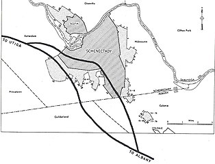
| 目前 | 2005年12月25日 (日) 09:37 | | 800 × 611(108 KB) | SPUI~commonswiki | {{PD-USGov}} City map from the 1955 "Yellow Book" of Interstate Highway System plans, from [http://www.ajfroggie.com/roads/yellowbook/]. Category:1955 Yellow Book maps |
檔案用途
沒有使用此檔案的頁面。
全域檔案使用狀況
以下其他 wiki 使用了這個檔案:
- en.wikipedia.org 的使用狀況
- en.wikisource.org 的使用狀況