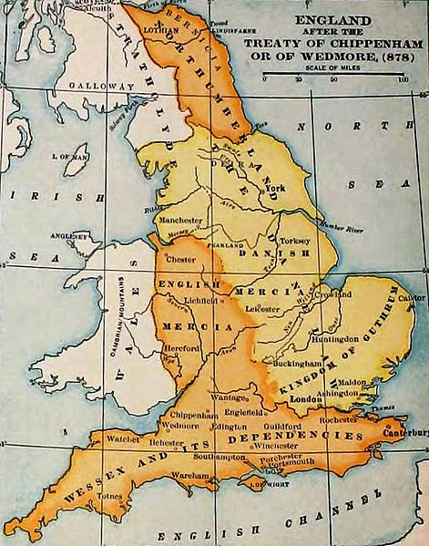
File:England-878ad.jpg

本预览的尺寸:471 × 599像素。 其他分辨率:189 × 240像素 | 377 × 480像素 | 735 × 935像素。
原始文件 (735 × 935像素,文件大小:127 KB,MIME类型:image/jpeg)
文件历史
点击某个日期/时间查看对应时刻的文件。
| 日期/时间 | 缩略图 | 大小 | 用户 | 备注 | |
|---|---|---|---|---|---|
| 当前 | 2011年11月7日 (一) 19:27 |  | 735 × 935(127 KB) | Hel-hama | same source, better version of the image |
| 2006年12月29日 (五) 15:49 |  | 693 × 879(79 KB) | Electionworld | {{ew|en|Adamsan}} England and Wales at the time of the Treaty of Chippenham (AD 878). From the Atlas of European History, Earle W Dowe, G Bell and Sons, London, 1910 {{PD-US}} |
文件用途
以下页面使用本文件:
全域文件用途
以下其他wiki使用此文件:
- ar.wikipedia.org上的用途
- br.wikipedia.org上的用途
- cs.wikipedia.org上的用途
- en.wikipedia.org上的用途
- Talk:Sub-Roman Britain
- Portal:Denmark/Selected article/2006 archive
- Portal:Denmark/Selected article/Week 20, 2006
- Portal:Denmark/Selected article/2007 archive
- Portal:Denmark/Selected article/Week 4, 2007
- Portal:Denmark/Selected article/Week 5, 2007
- Portal:Denmark/Selected article/Week 45, 2007
- Portal:Denmark/Selected article/Week 46, 2007
- Portal:Denmark/Selected article/2008 archive
- Portal:Denmark/Selected article/Week 3, 2008
- User:Amitchell125/danelaw
- eo.wikipedia.org上的用途
- fa.wikipedia.org上的用途
- fy.wikipedia.org上的用途
- hu.wikipedia.org上的用途
- id.wikipedia.org上的用途
- is.wikipedia.org上的用途
- it.wikipedia.org上的用途
- ja.wikipedia.org上的用途
- pt.wikipedia.org上的用途
- sh.wikipedia.org上的用途
- simple.wikipedia.org上的用途
- sk.wikipedia.org上的用途
- th.wikipedia.org上的用途
- uk.wikipedia.org上的用途


