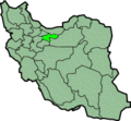
File:IranTehran.png

本预览的尺寸:648 × 599像素。 其他分辨率:260 × 240像素 | 519 × 480像素 | 879 × 813像素。
原始文件 (879 × 813像素,文件大小:25 KB,MIME类型:image/png)
文件历史
点击某个日期/时间查看对应时刻的文件。
| 日期/时间 | 缩略图 | 大小 | 用户 | 备注 | |
|---|---|---|---|---|---|
| 当前 | 2013年6月24日 (一) 00:18 |  | 879 × 813(25 KB) | BasilLeaf | بروزرسانی مرز بین استانهای یزد و خراسان جنوبی، تهران و البرز، فارس و یزد و اصفهان |
| 2010年11月12日 (五) 12:05 |  | 879 × 813(41 KB) | M samadi | Quality improved, Border of some provinces updated. | |
| 2010年9月25日 (六) 13:47 |  | 200 × 185(16 KB) | Amin19850 | tehran and alborz province is devided | |
| 2006年11月8日 (三) 21:01 |  | 200 × 185(11 KB) | Raymond | transparent background, improved color palette | |
| 2005年9月6日 (二) 06:08 |  | 200 × 185(22 KB) | Roozbeh | updated with new Khorasan(s) and expandion of Yazd | |
| 2005年8月22日 (一) 22:38 |  | 200 × 185(20 KB) | Kotoito | {Information| |Description = Province of Tehran, Iran |Source = http://en.wikipedia.org/wiki/Image:IranTehran.png |Date = ファイルの作成および発表日を記入しましょう。 |Author = Morven |Permission = GDFL }} |
文件用途
没有页面链接到本图像。
全域文件用途
以下其他wiki使用此文件:
- ar.wikipedia.org上的用途
- az.wikipedia.org上的用途
- bn.wikipedia.org上的用途
- ca.wikipedia.org上的用途
- ckb.wikipedia.org上的用途
- cy.wikipedia.org上的用途
- da.wikipedia.org上的用途
- el.wikipedia.org上的用途
- en.wikipedia.org上的用途
- Damavand, Iran
- Kilan
- Shemshak
- Andisheh
- Parand
- Mellat Park
- Darband, Tehran
- Jamshidieh Park
- Mosha
- Gisha
- Laleh Park
- Vanak
- Shahr-e Bazi
- Shah Street
- Tehranpars
- Amir Abad
- Niavaran Park
- Sadeghiyeh
- Giliard
- Evin
- Pasdaran (district)
- Farmanieh
- List of Assyrian settlements
- Sa'adat Abad
- Tangeh-ye Vashi
- Firuzkuh
- Seyed Khandan
- Robat Karim
- Golestan District (Baharestan County)
- Pakdasht
- Qarchak
- User:AlexNebraska/Images of Iran
- Qods, Iran
- Shahriar, Tehran province
- Golestan, Tehran
- Malard
- Nasimshahr
- Afjeh
- Abali
- Namrud
- Javadabad, Varamin
查看此文件的更多全域用途。


