File:Ottawarivermap.png
Ottawarivermap.png (500 × 500像素,文件大小:146 KB,MIME类型:image/png)
文件历史
点击某个日期/时间查看对应时刻的文件。
| 日期/时间 | 缩略图 | 大小 | 用户 | 备注 | |
|---|---|---|---|---|---|
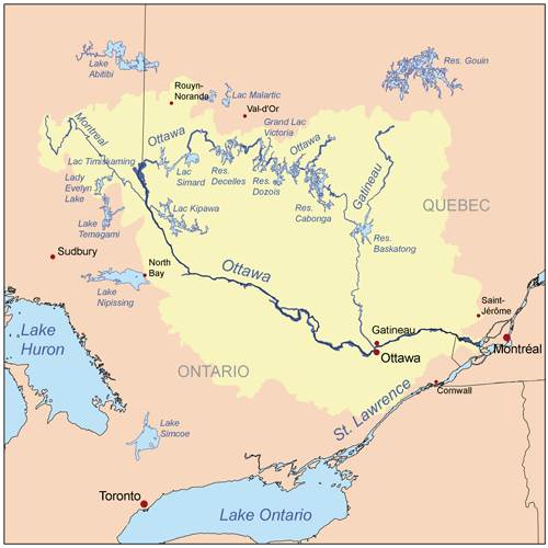
| 当前 | 2007年10月23日 (二) 20:11 |  | 500 × 500(146 KB) | Kmusser | {{Information |Description=This is a map of the Ottawa River drainage basin, created based on USGS and Digital Chart of the World data. [http://ottawariverkeeper.ca/river/maps/] used as |
文件用途
以下页面使用本文件:
全域文件用途
以下其他wiki使用此文件:
- af.wikipedia.org上的用途
- azb.wikipedia.org上的用途
- be.wikipedia.org上的用途
- bg.wikipedia.org上的用途
- cs.wikipedia.org上的用途
- da.wikipedia.org上的用途
- de.wikipedia.org上的用途
- en.wikipedia.org上的用途
- Ottawa River
- Gatineau River
- La Pêche River
- User:Kmusser/Images
- Great Lakes–St. Lawrence Lowlands
- Canadian canoe routes
- User:Kayoty/sandbox
- Ottawa River drainage basin
- Saint-Cyr River (Ottawa River tributary)
- Blondeau River (Fraser River tributary)
- Bazin River
- Douville River
- Gosselin River (Fortier River tributary)
- Tamarac River (Gatineau River tributary)
- Rivière à l'Ours (Témiscamingue)
- Rivière à la Loutre (Témiscamingue)
- eo.wikipedia.org上的用途
- es.wikipedia.org上的用途
- et.wikipedia.org上的用途
- fi.wikipedia.org上的用途
- fr.wikipedia.org上的用途
查看此文件的更多全域用途。

