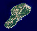
File:EO1 ALI Lamay Island.jpg
EO1_ALI_Lamay_Island.jpg (530 × 455像素,文件大小:227 KB,MIME类型:image/jpeg)
文件历史
点击某个日期/时间查看对应时刻的文件。
| 日期/时间 | 缩略图 | 大小 | 用户 | 备注 | |
|---|---|---|---|---|---|
| 当前 | 2014年10月17日 (五) 07:35 |  | 530 × 455(227 KB) | Philipxd | CROP BLACK STRIP |
| 2014年10月17日 (五) 07:34 |  | 799 × 664(271 KB) | Philipxd | crop black strip | |
| 2012年8月30日 (四) 03:18 |  | 799 × 664(271 KB) | Macos8 | {{Information |Description ={{en|1=The Advanced Land Imager (ALI) on NASA’s Earth Observing-1 satellite captured this image of Lamay Island offshore southwestern Taiwan. This 10-meter resolution false-colored image shows the old airstrip has been ... |
文件用途
全域文件用途
以下其他wiki使用此文件:
- ceb.wikipedia.org上的用途
- cs.wikipedia.org上的用途
- en.wikipedia.org上的用途
- fa.wikipedia.org上的用途
- fi.wikipedia.org上的用途
- fr.wikipedia.org上的用途
- it.wikipedia.org上的用途
- lld.wikipedia.org上的用途
- www.wikidata.org上的用途
- zh-yue.wikipedia.org上的用途
- zh.wikivoyage.org上的用途


