File:Hurricane irene 082811 0832 edt.jpg
預覽大小:800 × 564 像素。 其他解析度:320 × 226 像素 | 640 × 451 像素 | 1,024 × 722 像素 | 1,280 × 903 像素 | 1,500 × 1,058 像素。
原始檔案 (1,500 × 1,058 像素,檔案大小:566 KB,MIME 類型:image/jpeg)
摘要
| 描述 |
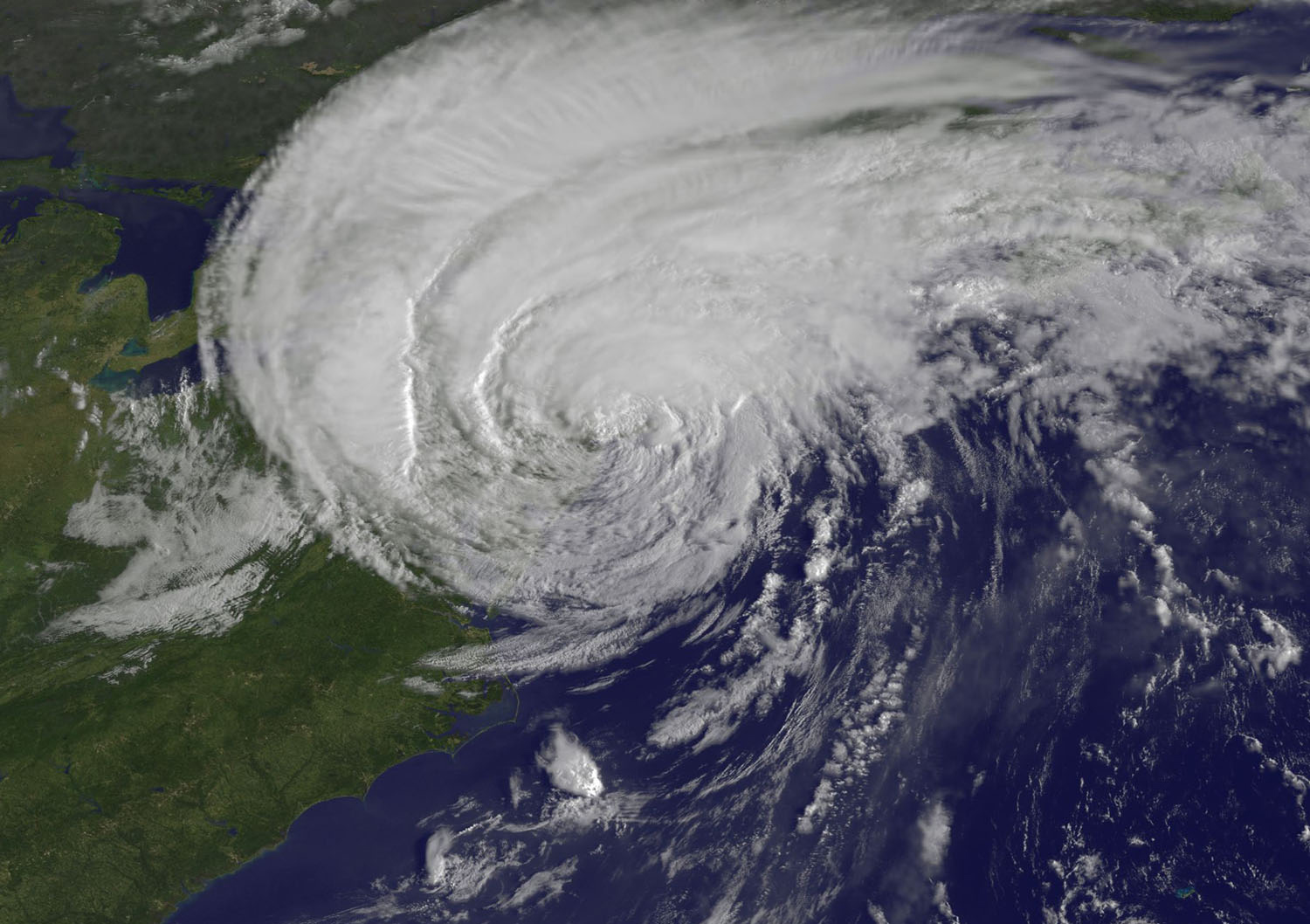
English: The GOES-13 satellite captured this stunning visible image of Hurricane Irene at 8:32 a.m. EDT, just 28 minutes before Irene's landfall in New York City. The image showed Irene's huge cloud cover blanketing New England, New York and over Toronto, Canada. Shadows in Irene's clouds indicate the bands of thunderstorms that surround now tropical storm Irene. (Credit: NASA/NOAA GOES Project) |
| 日期 | |
| 來源 | NASA Satellite Confirms Irene as a Big Rainmaker, She Makes Landfall in NYC |
| 作者 | NASA/NOAA GOES Project |
授權條款
| 本作品由NASA創作,屬於公有領域。根據NASA的版權政策:“NASA的創作除非另有聲明否則不受版權保護。”(參見:Template:PD-USGov/zh,NASA版權政策或JPL圖像使用政策) | ||
 |
警告:
|
檔案歷史
點選日期/時間以檢視該時間的檔案版本。
| 日期/時間 | 縮圖 | 尺寸 | 使用者 | 備註 | |
|---|---|---|---|---|---|
| 目前 | 2011年8月28日 (日) 15:25 | | 1,500 × 1,058(566 KB) | ComputerHotline | {{Information |Description={{en|The GOES-13 satellite captured this stunning visible image of Hurricane Irene at 8:32 a.m. EDT, just 28 minutes before Irene's landfall in New York City. The image showed Irene's huge cloud cover blanketing New England, New |
檔案用途
下列2個頁面有用到此檔案:
全域檔案使用狀況
以下其他 wiki 使用了這個檔案:
- en.wikipedia.org 的使用狀況
- fi.wikipedia.org 的使用狀況
- it.wikipedia.org 的使用狀況