沙提難民營
加沙地带难民营
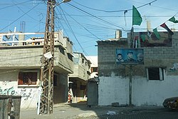
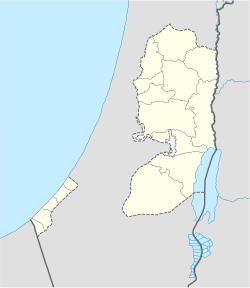
沙提難民營(阿拉伯語:مخيّم الشاطئ),又稱海灘難民營,是巴勒斯坦國加沙省北部地中海沿岸的一個巴勒斯坦難民營,位於加沙城內,總土地面積為520杜納畝[1]。根據巴勒斯坦中央統計局的數據,2006年年中沙提的人口為87,158人,而聯合國近東巴勒斯坦難民救濟和工程處報告的登記難民人數為78,800人。該難民營是巴勒斯坦難民營中的第三大難民營。
| 沙提難民營 | |
|---|---|
| 巴勒斯坦難民營 | |
| 阿拉伯轉寫 | |
| • 阿拉伯文字 | مخيّم الشاطئ |
| • 拉丁字母 | ash-Shati (official) Beach camp (unofficial) |
 沙提難民營 | |
巴勒斯坦國沙提難民營 | |
| 坐標:31°31′55.91″N 34°26′43.42″E / 31.5321972°N 34.4453944°E | |
| State | 巴勒斯坦國 |
| 巴勒斯坦行政區劃 | 加沙省 |
| 政府 | |
| • 類型 | 巴勒斯坦難民營 (1949年以來) |
| 面積 | |
| • 總計 | 0.52 平方公里(0.20 平方英里) |
| 人口(2006) | |
| • 總計 | 87,158人 |
| • 密度 | 167,612人/平方公里(434,112人/平方英里) |
沙提難民營成立於1948年,當時約有23,000名巴勒斯坦人在1948年阿拉伯-以色列戰爭期間從雅法、盧德和貝爾謝巴以及周圍的村莊逃離至沙提並建立難民營。1971年,以色列當局出於安全考慮,拆除了2000多個避難所並拓寬道路。大約8,000名難民被迫離開難民營前往附近的加薩謝赫拉德萬[1][2][3][4]。
參考文獻
編輯- ^ 1.0 1.1 Beach Camp (頁面存檔備份,存於網際網路檔案館) 聯合國近東巴勒斯坦難民救濟和工程處
- ^ Badil 網際網路檔案館的存檔,存檔日期2012-02-16. During the 1970s, the Israeli military administration destroyed thousands of refugee shelters in the occupied Gaza Strip under the guise of security. Large refugee camps were targeted in particular. Refugees were forcefully resettled in other areas of the occupied Gaza Strip, with a smaller number transferred to the occupied West Bank. In the occupied Gaza Strip, several housing projects were established for these refugees. Some of these projects today are referred to as camps. These include the Canada project (1972), the Shuqairi project (1973), the Brazil project (1973), the Sheikh Radwan project (1974), and the al-Amal project (1979).
- ^ Palestine Israel Journal (頁面存檔備份,存於網際網路檔案館) Refugee Resettlement: The Gaza Strip Experience by Norma Masriyeh
- ^ Badil 網際網路檔案館的存檔,存檔日期2009-02-27. The Continuing Catastrophe --1967 and beyond
- ^ Profile: Hamas PM Ismail Haniya. BBC. 14 December 2006 [2021-05-18]. (原始內容存檔於2021-12-18).
- ^ Obituary: Hamas leader Said Siyam. BBC. 16 January 2009 [16 January 2009]. (原始內容存檔於2021-11-09).
